State ProfileNY
New York
Population: 20,201,249ZIP codes: 2,088Cities: 1,546Counties: 62
Demographics
Source: U.S. Census Bureau (ACS/Decennial). See data sources
People
Total population
20,201,249
People
Median age
40.1
Housing
Total households
7,828,074
Income
Median household income
$85,820
Housing
Total housing units
8,676,911
Employment
Employment rate
59.5%
Education
Bachelor’s degree or higher
41.2%
Healthcare
Insured population
95%
New York details
| Capital | Albany |
|---|---|
| State Code | NY |
| Timezone | Eastern Time (ET) |
| Coordinates | 43, -75 |
| Land area | 54,555 sq mi(141,296.9 km²) |
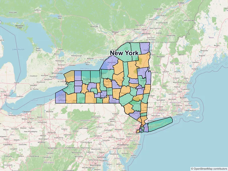
Map of New York ZIP codes
Loading…
Major cities in New York
Browse major cities in NY with population and key demographic indicators.
| City | County | Population | Median incomeHousehold | ZIP codes |
|---|---|---|---|---|
| New York | 8,804,190 | $80,483 | 145ZIPs | |
| Kings | 2,735,593 | — | 47ZIPs | |
| Bronx | 1,477,398 | — | 25ZIPs | |
| Richmond | 495,747 | — | 14ZIPs | |
| Erie | 278,349 | $50,041 | 44ZIPs | |
| Queens | 254,326 | — | 14ZIPs | |
| Queens | 234,288 | — | 8ZIPs | |
| Westchester | 211,569 | $83,549 | 6ZIPs | |
| Monroe | 211,328 | $47,213 | 40ZIPs | |
| Queens | 154,553 | — | 4ZIPs | |
| Onondaga | 148,620 | $47,819 | 28ZIPs | |
| Queens | 117,110 | — | 1ZIPs | |
| Queens | 105,712 | — | 2ZIPs | |
| Queens | 100,883 | — | 2ZIPs | |
| Albany | 99,224 | $61,986 | 48ZIPs | |
| Queens | 91,512 | — | 1ZIPs | |
| Westchester | 79,726 | $109,167 | 4ZIPs | |
| Queens | 77,140 | — | 4ZIPs | |
| Queens | 75,488 | — | 2ZIPs | |
| Westchester | 73,893 | $78,779 | 4ZIPs | |
| Queens | 72,851 | — | 1ZIPs | |
| Queens | 69,966 | — | 3ZIPs | |
| Queens | 68,000 | — | 1ZIPs | |
| Schenectady | 67,047 | $58,399 | 11ZIPs | |
| Oneida | 65,283 | $52,484 | 6ZIPs | |
| Suffolk | 62,387 | — | 1ZIPs | |
| Queens | 61,338 | — | 2ZIPs | |
| Queens | 59,610 | — | 2ZIPs | |
| Westchester | 59,559 | $110,763 | 7ZIPs | |
| Nassau | 59,169 | $90,420 | 3ZIPs | |
| Queens | 57,267 | — | 3ZIPs | |
| Nassau | 51,758 | $146,068 | 1ZIPs | |
| Rensselaer | 51,401 | $58,477 | 4ZIPs | |
| Queens | 49,155 | — | 3ZIPs | |
| Niagara | 48,671 | $49,101 | 5ZIPs | |
| Broome | 47,969 | $45,578 | 5ZIPs | |
| Queens | 47,430 | — | 1ZIPs | |
| Queens | 47,383 | — | 1ZIPs | |
| Queens | 47,129 | — | 1ZIPs | |
| Nassau | 44,472 | $120,625 | 1ZIPs | |
| Saratoga | 43,893 | — | 1ZIPs | |
| Nassau | 43,869 | $144,471 | 3ZIPs | |
| Suffolk | 43,213 | $129,519 | 2ZIPs | |
| Queens | 42,978 | — | 1ZIPs | |
| Queens | 42,586 | — | 1ZIPs | |
| Queens | 42,319 | — | 1ZIPs | |
| Nassau | 40,634 | $133,190 | 3ZIPs | |
| Suffolk | 40,220 | $105,220 | 1ZIPs | |
| Queens | 38,288 | — | 1ZIPs | |
| Queens | 37,958 | — | 1ZIPs | |
| Queens | 37,906 | — | 1ZIPs | |
| Nassau | 37,796 | $133,971 | 1ZIPs | |
| Queens | 37,596 | — | 1ZIPs | |
| Queens | 37,032 | — | 1ZIPs | |
| Suffolk | 36,714 | $113,707 | 1ZIPs | |
| Suffolk | 36,536 | $169,792 | 1ZIPs | |
| Nassau | 35,265 | $114,217 | 1ZIPs | |
| Nassau | 35,029 | $140,739 | 1ZIPs | |
| Suffolk | 34,878 | $135,477 | 1ZIPs | |
| Rockland | 34,135 | $173,046 | 1ZIPs | |
| Nassau | 33,919 | $145,472 | 1ZIPs | |
| Rockland | 33,066 | $57,196 | 1ZIPs | |
| Queens | 32,839 | — | 1ZIPs | |
| Nassau | 32,637 | $149,560 | 1ZIPs | |
| Nassau | 32,473 | $124,684 | 3ZIPs | |
| Oneida | 32,127 | $59,925 | 4ZIPs | |
| Tompkins | 32,108 | $48,784 | 4ZIPs | |
| Queens | 31,985 | — | 1ZIPs | |
| Westchester | 31,693 | $92,222 | 1ZIPs | |
| Dutchess | 31,577 | $60,741 | 4ZIPs | |
| Suffolk | 30,980 | $132,240 | 1ZIPs | |
| Nassau | 30,903 | $143,263 | 1ZIPs | |
| Niagara | 30,496 | $66,961 | 1ZIPs | |
| Orange | 30,345 | $79,346 | 2ZIPs | |
| Suffolk | 29,244 | $105,618 | 1ZIPs | |
| Orange | 28,856 | $56,960 | 4ZIPs | |
| Suffolk | 28,837 | $137,105 | 1ZIPs | |
| Chautauqua | 28,712 | $43,523 | 2ZIPs | |
| Saratoga | 28,491 | $105,944 | 1ZIPs | |
| Nassau | 28,365 | $92,064 | 1ZIPs | |
| Queens | 28,310 | — | 1ZIPs | |
| Westchester | 28,218 | $164,250 | 1ZIPs | |
| Warren | 27,790 | — | 1ZIPs | |
| Westchester | 27,551 | $103,573 | 1ZIPs | |
| Queens | 27,407 | — | 1ZIPs | |
| Queens | 27,320 | — | 1ZIPs | |
| Suffolk | 27,148 | $130,128 | 1ZIPs | |
| Nassau | 27,100 | $189,906 | 1ZIPs | |
| Suffolk | 27,048 | $176,281 | 1ZIPs | |
| Rockland | 26,954 | $47,629 | 1ZIPs | |
| Cayuga | 26,866 | $51,052 | 3ZIPs | |
| Chemung | 26,523 | $43,120 | 5ZIPs | |
| Suffolk | 26,487 | $144,760 | 1ZIPs | |
| Suffolk | 26,360 | $112,788 | 1ZIPs | |
| Nassau | 26,016 | $151,938 | 2ZIPs | |
| Suffolk | 25,629 | $150,664 | 1ZIPs | |
| Westchester | 25,431 | $85,954 | 1ZIPs | |
| Queens | 25,347 | — | 2ZIPs | |
| Jefferson | 24,685 | $51,753 | 2ZIPs | |
| Suffolk | 24,247 | $128,192 | 1ZIPs | |
| Ulster | 24,069 | $68,186 | 2ZIPs | |
| Suffolk | 23,429 | $127,369 | 1ZIPs | |
| Nassau | 23,272 | $244,152 | 3ZIPs | |
| Queens | 22,776 | — | 1ZIPs | |
| Broome | 22,135 | — | 2ZIPs | |
| Nassau | 22,040 | $185,740 | 1ZIPs | |
| Erie | 21,389 | — | 1ZIPs | |
| Nassau | 21,355 | $181,846 | 1ZIPs | |
| Suffolk | 21,262 | $108,952 | 1ZIPs | |
| Monroe | 20,932 | — | 1ZIPs | |
| Westchester | 20,901 | $157,202 | 1ZIPs | |
| Niagara | 20,876 | $62,410 | 2ZIPs | |
| Nassau | 20,800 | $137,739 | 1ZIPs | |
| Erie | 20,721 | — | 1ZIPs | |
| Nassau | 20,438 | $136,696 | 1ZIPs | |
| Westchester | 20,400 | — | 1ZIPs | |
| Queens | 20,241 | — | 1ZIPs | |
| Westchester | 20,151 | $120,000 | 1ZIPs | |
| Suffolk | 20,083 | $141,378 | 1ZIPs | |
| Suffolk | 20,048 | $157,662 | 1ZIPs | |
| Clinton | 19,841 | $57,630 | 2ZIPs | |
| Nassau | 19,835 | $164,127 | 1ZIPs | |
| Queens | 19,780 | — | 1ZIPs | |
| Suffolk | 19,645 | $168,095 | 1ZIPs | |
| Queens | 19,579 | — | 1ZIPs | |
| Suffolk | 19,284 | $159,922 | 4ZIPs | |
| Nassau | 19,259 | $187,273 | 1ZIPs | |
| Suffolk | 18,955 | $121,673 | 1ZIPs | |
| Suffolk | 18,937 | $133,679 | 3ZIPs | |
| Rockland | 18,886 | $117,167 | 1ZIPs | |
| Nassau | 18,669 | $172,537 | 1ZIPs | |
| Nassau | 18,613 | $179,362 | 1ZIPs | |
| Suffolk | 18,418 | $120,909 | 1ZIPs | |
| Westchester | 18,253 | $250,001 | 1ZIPs | |
| Montgomery | 18,219 | $56,178 | 1ZIPs | |
| Albany | 18,147 | $61,145 | 1ZIPs | |
| Nassau | 18,066 | $135,069 | 1ZIPs | |
| Suffolk | 17,927 | $140,342 | 1ZIPs | |
| Cortland | 17,556 | $59,482 | 1ZIPs | |
| Onondaga | 17,485 | — | 1ZIPs | |
| Saratoga | 17,483 | — | 1ZIPs | |
| Albany | 17,282 | — | 1ZIPs | |
| Nassau | 17,109 | $171,953 | 1ZIPs | |
| Suffolk | 17,085 | $121,136 | 1ZIPs | |
| Oswego | 16,921 | $53,172 | 1ZIPs | |
| Nassau | 16,753 | $170,127 | 6ZIPs | |
| Nassau | 16,658 | $122,257 | 1ZIPs | |
| Westchester | 16,592 | $239,815 | 1ZIPs | |
| Suffolk | 16,569 | $147,120 | 1ZIPs | |
| Rockland | 16,567 | $145,063 | 1ZIPs | |
| Nassau | 16,297 | $161,674 | 1ZIPs | |
| Nassau | 16,172 | $150,084 | 3ZIPs | |
| Jefferson | 15,896 | $62,291 | 1ZIPs | |
| Nassau | 15,864 | $145,185 | 1ZIPs | |
| Saratoga | 15,826 | — | 1ZIPs | |
| Genesee | 15,600 | $59,446 | 2ZIPs | |
| Suffolk | 15,404 | $94,034 | 1ZIPs | |
| Orange | 15,343 | $56,283 | 1ZIPs | |
| Broome | 15,343 | $56,283 | 1ZIPs | |
| Nassau | 15,251 | $172,557 | 1ZIPs | |
| Suffolk | 15,228 | $134,216 | 1ZIPs | |
| Erie | 15,178 | $73,556 | 1ZIPs | |
| Fulton | 15,131 | $51,556 | 1ZIPs | |
| Erie | 15,129 | $58,326 | 2ZIPs | |
| Suffolk | 14,993 | $83,008 | 1ZIPs | |
| Suffolk | 14,983 | $127,988 | 1ZIPs | |
| Warren | 14,830 | $67,788 | 1ZIPs | |
| Nassau | 14,808 | $167,935 | 2ZIPs | |
| Suffolk | 14,317 | $139,201 | 1ZIPs | |
| Suffolk | 14,199 | $111,493 | 1ZIPs | |
| Cattaraugus | 13,937 | $51,261 | 1ZIPs | |
| Suffolk | 13,931 | $147,996 | 1ZIPs | |
| Dutchess | 13,769 | $107,859 | 1ZIPs | |
| Albany | 13,680 | $104,899 | 1ZIPs | |
| Broome | 13,667 | $47,290 | 3ZIPs | |
| Suffolk | 13,661 | $164,427 | 1ZIPs | |
| Suffolk | 13,633 | $127,024 | 1ZIPs | |
| Queens | 13,608 | — | 1ZIPs | |
| Suffolk | 13,487 | $142,368 | 1ZIPs | |
| Suffolk | 13,467 | $174,872 | 2ZIPs | |
| Suffolk | 13,271 | $78,528 | 1ZIPs | |
| Suffolk | 13,207 | $152,500 | 1ZIPs | |
| Monroe | 13,089 | — | 1ZIPs | |
| Otsego | 13,079 | $61,111 | 1ZIPs | |
| Ontario | 13,068 | — | 1ZIPs | |
| Suffolk | 12,990 | — | 1ZIPs | |
| Ontario | 12,812 | $79,435 | 1ZIPs | |
| Chautauqua | 12,743 | $53,299 | 1ZIPs | |
| Suffolk | 12,408 | $107,306 | 1ZIPs | |
| Rockland | 12,323 | $75,167 | 1ZIPs | |
| Suffolk | 12,188 | $140,820 | 1ZIPs | |
| Rockland | 12,126 | $125,667 | 1ZIPs | |
| Westchester | 11,860 | $107,106 | 1ZIPs | |
| Broome | 11,762 | $82,726 | 1ZIPs | |
| Onondaga | 11,724 | — | 1ZIPs | |
| Suffolk | 11,723 | $146,492 | 1ZIPs | |
| Suffolk | 11,623 | $162,188 | 1ZIPs | |
| Westchester | 11,541 | $165,417 | 1ZIPs | |
| Westchester | 11,526 | — | 1ZIPs | |
| Rockland | 11,441 | $104,607 | 1ZIPs | |
| Oswego | 11,389 | $52,046 | 1ZIPs | |
| Nassau | 11,340 | $94,342 | 1ZIPs | |
| Nassau | 11,145 | $137,981 | 7ZIPs | |
| Suffolk | 11,072 | $118,311 | 1ZIPs | |
| Suffolk | 10,998 | $151,603 | 1ZIPs | |
| Westchester | 10,959 | $96,534 | 1ZIPs | |
| Rockland | 10,678 | $86,301 | 1ZIPs | |
| Ontario | 10,576 | $64,929 | 1ZIPs | |
| Steuben | 10,551 | $61,760 | 2ZIPs | |
| Suffolk | 10,546 | $85,480 | 1ZIPs | |
| Albany | 10,375 | $57,919 | 1ZIPs | |
| Madison | 10,329 | $61,597 | 1ZIPs | |
| Nassau | 10,257 | $142,927 | 2ZIPs | |
| Nassau | 10,159 | $124,929 | 1ZIPs | |
| St. Lawrence | 10,151 | $51,458 | 1ZIPs | |
| St. Lawrence | 10,064 | $61,824 | 1ZIPs | |
| Erie | 10,027 | $66,148 | 1ZIPs | |
| Onondaga | 10,019 | — | 1ZIPs | |
| Suffolk | 9,852 | $125,781 | 1ZIPs | |
| Erie | 9,696 | $112,292 | 1ZIPs | |
| Chautauqua | 9,585 | $50,433 | 1ZIPs | |
| Monroe | 9,526 | — | 1ZIPs | |
| Suffolk | 9,500 | $106,285 | 1ZIPs | |
| Rockland | 9,489 | — | 1ZIPs | |
| Orange | 9,343 | $109,851 | 2ZIPs | |
| Nassau | 9,335 | $191,321 | 1ZIPs | |
| Orange | 9,331 | — | 1ZIPs | |
| Erie | 9,280 | — | 1ZIPs | |
| Rensselaer | 9,210 | $70,080 | 1ZIPs | |
| Rockland | 9,038 | $133,117 | 1ZIPs | |
| Wayne | 9,017 | $60,006 | 1ZIPs | |
| Putnam | 8,932 | $110,023 | 1ZIPs | |
| Orange | 8,882 | $81,340 | 1ZIPs | |
| Orange | 8,775 | $47,917 | 1ZIPs | |
| Putnam | 8,633 | — | 1ZIPs | |
| Suffolk | 8,609 | $147,818 | 1ZIPs | |
| Westchester | 8,590 | $193,621 | 1ZIPs | |
| Nassau | 8,560 | $149,489 | 1ZIPs | |
| Rockland | 8,532 | $147,000 | 1ZIPs | |
| Albany | 8,524 | — | 1ZIPs | |
| Westchester | 8,510 | — | 1ZIPs | |
| Nassau | 8,466 | $122,980 | 2ZIPs | |
| Westchester | 8,327 | $191,678 | 2ZIPs | |
| St. Lawrence | 8,312 | $34,546 | 2ZIPs | |
| Steuben | 8,263 | $47,385 | 1ZIPs | |
| Fulton | 8,204 | $63,763 | 1ZIPs | |
| Nassau | 8,176 | $165,932 | 1ZIPs | |
| Erie | 8,157 | — | 1ZIPs | |
| Suffolk | 8,046 | $170,277 | 1ZIPs | |
| Suffolk | 7,962 | $144,912 | 1ZIPs | |
| Suffolk | 7,950 | $120,734 | 1ZIPs | |
| Onondaga | 7,898 | $77,241 | 1ZIPs | |
| Suffolk | 7,731 | $136,549 | 1ZIPs | |
| Dutchess | 7,666 | — | 1ZIPs | |
| Herkimer | 7,646 | $62,843 | 1ZIPs | |
| Nassau | 7,591 | $156,382 | 1ZIPs | |
| Putnam | 7,586 | — | 1ZIPs | |
| Livingston | 7,574 | $46,589 | 1ZIPs | |
| Westchester | 7,569 | $229,732 | 1ZIPs | |
| Putnam | 7,538 | $114,954 | 1ZIPs | |
| Westchester | 7,513 | $136,406 | 1ZIPs | |
| Suffolk | 7,430 | $118,958 | 1ZIPs | |
| Washington | 7,427 | $62,969 | 1ZIPs | |
| Suffolk | 7,416 | $132,008 | 1ZIPs | |
| Erie | 7,399 | — | 1ZIPs | |
| Nassau | 7,374 | $101,572 | 1ZIPs | |
| Suffolk | 7,347 | $146,921 | 1ZIPs | |
| Orange | 7,341 | $135,333 | 2ZIPs | |
| Westchester | 7,326 | $184,375 | 1ZIPs | |
| Ulster | 7,324 | $52,774 | 1ZIPs | |
| Westchester | 7,293 | — | 1ZIPs | |
| Rockland | 7,265 | $116,649 | 1ZIPs | |
| Nassau | 7,262 | $140,765 | 1ZIPs | |
| Herkimer | 7,234 | $48,529 | 1ZIPs | |
| Sullivan | 7,173 | $50,583 | 1ZIPs | |
| St. Lawrence | 7,155 | $62,054 | 1ZIPs | |
| Monroe | 7,104 | $69,866 | 1ZIPs | |
| Chenango | 7,051 | $53,333 | 1ZIPs | |
| Nassau | 7,049 | $111,264 | 1ZIPs | |
| Dutchess | 6,825 | — | 1ZIPs | |
| Orange | 6,818 | $87,487 | 1ZIPs | |
| Nassau | 6,809 | $170,000 | 1ZIPs | |
| Seneca | 6,809 | $59,864 | 1ZIPs | |
| Nassau | 6,748 | $149,191 | 1ZIPs | |
| Nassau | 6,747 | $175,263 | 1ZIPs | |
| Albany | 6,739 | — | 1ZIPs | |
| Monroe | 6,734 | — | 1ZIPs | |
| Rockland | 6,673 | $174,286 | 1ZIPs | |
| Westchester | 6,656 | $215,815 | 1ZIPs | |
| Westchester | 6,652 | $173,248 | 1ZIPs | |
| Orange | 6,652 | $89,609 | 1ZIPs | |
| Westchester | 6,630 | $167,536 | 1ZIPs | |
| Chemung | 6,606 | $61,223 | 1ZIPs | |
| Westchester | 6,556 | — | 1ZIPs | |
| Nassau | 6,403 | $195,202 | 1ZIPs | |
| Ulster | 6,385 | $101,917 | 1ZIPs | |
| Albany | 6,373 | — | 1ZIPs | |
| Monroe | 6,334 | $73,344 | 1ZIPs | |
| Rensselaer | 6,266 | $118,393 | 1ZIPs | |
| Erie | 6,152 | — | 1ZIPs | |
| Dutchess | 6,148 | — | 1ZIPs | |
| Dutchess | 6,103 | $65,040 | 1ZIPs | |
| Orleans | 6,047 | $59,231 | 1ZIPs | |
| Suffolk | 6,040 | $128,822 | 1ZIPs | |
| Monroe | 6,027 | $87,377 | 1ZIPs | |
| Westchester | 6,008 | — | 1ZIPs | |
| Erie | 5,998 | $103,949 | 1ZIPs | |
| Suffolk | 5,974 | $108,971 | 1ZIPs | |
| Suffolk | 5,946 | $139,222 | 1ZIPs | |
| Suffolk | 5,934 | $60,442 | 1ZIPs | |
| Cattaraugus | 5,929 | $41,667 | 1ZIPs | |
| Columbia | 5,894 | $54,139 | 1ZIPs | |
| Suffolk | 5,822 | $195,357 | 1ZIPs | |
| Orange | 5,777 | $104,643 | 1ZIPs | |
| Orange | 5,657 | $95,313 | 1ZIPs | |
| Monroe | 5,651 | $70,495 | 1ZIPs | |
| Orleans | 5,637 | $41,581 | 1ZIPs | |
| Orange | 5,622 | — | 1ZIPs | |
| Steuben | 5,571 | $47,150 | 1ZIPs | |
| Suffolk | 5,557 | $93,710 | 1ZIPs | |
| Chemung | 5,555 | $89,286 | 1ZIPs | |
| Rockland | 5,548 | $174,255 | 1ZIPs | |
| Monroe | 5,501 | $107,009 | 1ZIPs | |
| Franklin | 5,483 | $60,548 | 1ZIPs | |
| Suffolk | 5,323 | $155,313 | 1ZIPs | |
| Rockland | 5,240 | $133,623 | 1ZIPs | |
| Westchester | 5,239 | $120,179 | 1ZIPs | |
| Nassau | 5,220 | $132,955 | 1ZIPs | |
| Monroe | 5,177 | $73,314 | 1ZIPs | |
| Saratoga | 5,163 | $50,675 | 1ZIPs | |
| Suffolk | 5,156 | $154,625 | 1ZIPs | |
| Saratoga | 5,111 | $101,667 | 1ZIPs | |
| Westchester | 5,099 | — | 1ZIPs | |
| Westchester | 5,079 | $243,000 | 1ZIPs | |
| Nassau | 5,062 | $193,590 | 1ZIPs | |
| Yates | 5,056 | $60,190 | 1ZIPs | |
| Nassau | 5,005 | $145,500 | 1ZIPs | |
| Saratoga | 4,935 | — | 1ZIPs | |
| Nassau | 4,928 | $104,926 | 1ZIPs | |
| Madison | 4,896 | $70,786 | 1ZIPs | |
| Franklin | 4,887 | $61,967 | 1ZIPs | |
| Suffolk | 4,872 | $166,312 | 1ZIPs | |
| Westchester | 4,854 | — | 1ZIPs | |
| Nassau | 4,837 | $138,465 | 1ZIPs | |
| Seneca | 4,810 | $51,642 | 1ZIPs | |
| Sullivan | 4,700 | $64,913 | 1ZIPs | |
| Monroe | 4,694 | $76,368 | 1ZIPs | |
| Saratoga | 4,686 | — | 1ZIPs | |
| Saratoga | 4,663 | $94,982 | 1ZIPs | |
| Onondaga | 4,662 | $69,942 | 1ZIPs | |
| Albany | 4,658 | — | 1ZIPs | |
| Westchester | 4,646 | $140,856 | 1ZIPs | |
| Herkimer | 4,605 | $53,544 | 1ZIPs | |
| Orange | 4,604 | — | 1ZIPs | |
| Allegany | 4,587 | $55,096 | 1ZIPs | |
| Rockland | 4,565 | $106,906 | 1ZIPs | |
| Madison | 4,556 | $74,015 | 1ZIPs | |
| Suffolk | 4,550 | $214,032 | 2ZIPs | |
| Madison | 4,539 | — | 1ZIPs | |
| Westchester | 4,495 | $230,357 | 1ZIPs | |
| Queens | 4,468 | — | 1ZIPs | |
| Putnam | 4,447 | — | 1ZIPs | |
| Livingston | 4,433 | $57,329 | 1ZIPs | |
| Tioga | 4,373 | $54,274 | 1ZIPs | |
| Suffolk | 4,322 | $121,250 | 1ZIPs | |
| Suffolk | 4,318 | $142,961 | 1ZIPs | |
| Genesee | 4,300 | $58,818 | 1ZIPs | |
| Nassau | 4,289 | $250,001 | 1ZIPs | |
| Onondaga | 4,225 | $127,559 | 1ZIPs | |
| Erie | 4,225 | $71,996 | 1ZIPs | |
| Schoharie | 4,173 | $46,059 | 1ZIPs | |
| Ulster | 4,167 | $42,969 | 1ZIPs | |
| Madison | 4,107 | $66,750 | 1ZIPs | |
| Onondaga | 4,101 | — | 1ZIPs | |
| Rensselaer | 4,050 | $108,558 | 1ZIPs | |
| Allegany | 4,026 | $40,625 | 1ZIPs | |
| Chemung | 4,025 | — | 1ZIPs | |
| Broome | 4,004 | — | 1ZIPs | |
| Orange | 3,993 | $100,514 | 1ZIPs | |
| Wayne | 3,989 | $67,850 | 1ZIPs | |
| Westchester | 3,960 | $170,398 | 1ZIPs | |
| Saratoga | 3,958 | — | 1ZIPs | |
| Nassau | 3,948 | $131,573 | 1ZIPs | |
| Oneida | 3,941 | — | 1ZIPs | |
| Onondaga | 3,907 | $82,813 | 1ZIPs | |
| Ulster | 3,899 | $57,778 | 1ZIPs | |
| Oswego | 3,865 | — | 1ZIPs | |
| Orange | 3,834 | $90,214 | 1ZIPs | |
| Rockland | 3,824 | $156,000 | 1ZIPs | |
| Franklin | 3,789 | — | 1ZIPs | |
| Greene | 3,745 | $79,423 | 1ZIPs | |
| Saratoga | 3,744 | $58,542 | 1ZIPs | |
| Erie | 3,743 | — | 1ZIPs | |
| Oneida | 3,722 | — | 1ZIPs | |
| Ulster | 3,699 | $119,318 | 1ZIPs | |
| Delaware | 3,697 | $50,208 | 1ZIPs | |
| Monroe | 3,685 | $81,029 | 1ZIPs | |
| Orange | 3,684 | $110,714 | 1ZIPs | |
| Ulster | 3,678 | $79,386 | 1ZIPs | |
| Niagara | 3,662 | $77,096 | 1ZIPs | |
| Onondaga | 3,657 | $95,506 | 1ZIPs | |
| Tioga | 3,654 | $60,139 | 1ZIPs | |
| Rockland | 3,649 | $137,206 | 1ZIPs | |
| Tompkins | 3,648 | $72,364 | 1ZIPs | |
| Wyoming | 3,646 | $55,406 | 1ZIPs | |
| Suffolk | 3,621 | $119,886 | 1ZIPs | |
| Broome | 3,617 | — | 1ZIPs | |
| Oneida | 3,612 | $45,934 | 1ZIPs | |
| Orange | 3,588 | — | 1ZIPs | |
| Broome | 3,579 | — | 1ZIPs | |
| Jefferson | 3,573 | $57,668 | 1ZIPs | |
| Nassau | 3,571 | $152,472 | 1ZIPs | |
| Suffolk | 3,567 | $116,313 | 1ZIPs | |
| Orange | 3,562 | — | 1ZIPs | |
| Wyoming | 3,536 | $63,291 | 1ZIPs | |
| St. Lawrence | 3,526 | $35,752 | 1ZIPs | |
| Ulster | 3,508 | — | 1ZIPs | |
| Suffolk | 3,437 | $143,472 | 1ZIPs | |
| Livingston | 3,399 | $71,771 | 1ZIPs | |
| Westchester | 3,377 | $132,778 | 1ZIPs | |
| Orange | 3,368 | $70,688 | 1ZIPs | |
| Chautauqua | 3,367 | — | 1ZIPs | |
| Broome | 3,359 | — | 1ZIPs | |
| Erie | 3,346 | $84,900 | 1ZIPs | |
| Ulster | 3,346 | $90,152 | 1ZIPs | |
| Suffolk | 3,330 | $114,839 | 1ZIPs | |
| Wayne | 3,305 | $64,983 | 1ZIPs | |
| Clinton | 3,287 | $62,411 | 1ZIPs | |
| Franklin | 3,282 | $56,902 | 1ZIPs | |
| Schuyler | 3,273 | — | 1ZIPs | |
| Lewis | 3,272 | $68,450 | 1ZIPs | |
| Albany | 3,271 | $77,217 | 1ZIPs | |
| Dutchess | 3,267 | — | 1ZIPs | |
| Oswego | 3,263 | — | 1ZIPs | |
| Essex | 3,250 | $54,938 | 1ZIPs | |
| Oneida | 3,244 | $57,578 | 1ZIPs | |
| Westchester | 3,239 | $94,024 | 1ZIPs | |
| Jefferson | 3,236 | $58,125 | 1ZIPs | |
| Rensselaer | 3,216 | $48,214 | 1ZIPs | |
| Westchester | 3,213 | $134,037 | 1ZIPs | |
| Cortland | 3,210 | $72,472 | 1ZIPs | |
| Suffolk | 3,181 | $218,000 | 1ZIPs | |
| Monroe | 3,160 | — | 1ZIPs | |
| Orange | 3,150 | $72,389 | 1ZIPs | |
| Washington | 3,108 | $71,845 | 1ZIPs | |
| Erie | 3,108 | $99,904 | 1ZIPs | |
| Onondaga | 3,078 | $62,143 | 1ZIPs | |
| Oneida | 3,077 | $88,947 | 1ZIPs | |
| Orange | 3,075 | $140,208 | 1ZIPs | |
| Suffolk | 3,064 | $250,001 | 1ZIPs | |
| Warren | 3,045 | $57,245 | 1ZIPs | |
| Rockland | 3,036 | $108,043 | 1ZIPs | |
| Suffolk | 3,026 | $78,359 | 1ZIPs | |
| Ontario | 3,026 | — | 1ZIPs | |
| Oneida | 3,023 | — | 1ZIPs | |
| Rensselaer | 3,012 | — | 1ZIPs | |
| Chautauqua | 3,002 | $67,557 | 1ZIPs | |
| Erie | 2,996 | — | 1ZIPs | |
| Orange | 2,994 | $72,902 | 1ZIPs | |
| Nassau | 2,988 | $116,386 | 1ZIPs | |
| Erie | 2,983 | — | 1ZIPs | |
| Suffolk | 2,953 | $139,486 | 1ZIPs | |
| Essex | 2,931 | $62,063 | 3ZIPs | |
| Chautauqua | 2,910 | $46,774 | 1ZIPs | |
| Livingston | 2,898 | $51,125 | 1ZIPs | |
| Erie | 2,888 | $44,935 | 1ZIPs | |
| Orange | 2,888 | $123,250 | 1ZIPs | |
| Delaware | 2,885 | $34,676 | 1ZIPs | |
| Broome | 2,884 | $96,250 | 1ZIPs | |
| Westchester | 2,862 | $145,320 | 1ZIPs | |
| Franklin | 2,848 | — | 1ZIPs | |
| Albany | 2,841 | $111,172 | 1ZIPs | |
| Nassau | 2,792 | $204,071 | 1ZIPs | |
| Saratoga | 2,786 | — | 1ZIPs | |
| Dutchess | 2,784 | — | 1ZIPs | |
| Suffolk | 2,772 | $129,821 | 1ZIPs | |
| Madison | 2,767 | $92,857 | 1ZIPs | |
| Columbia | 2,755 | — | 1ZIPs | |
| Greene | 2,746 | $70,500 | 1ZIPs | |
| Ontario | 2,744 | $90,227 | 1ZIPs | |
| Erie | 2,733 | $88,269 | 1ZIPs | |
| Onondaga | 2,730 | — | 1ZIPs | |
| Delaware | 2,721 | $57,586 | 1ZIPs | |
| Orange | 2,714 | $83,488 | 1ZIPs | |
| Monroe | 2,706 | $82,162 | 1ZIPs | |
| Dutchess | 2,697 | $70,496 | 1ZIPs | |
| Broome | 2,678 | — | 1ZIPs | |
| Oneida | 2,657 | $72,969 | 1ZIPs | |
| Cayuga | 2,655 | — | 1ZIPs | |
| Tioga | 2,632 | $81,337 | 1ZIPs | |
| Chautauqua | 2,617 | $63,854 | 1ZIPs | |
| Rensselaer | 2,616 | $121,250 | 1ZIPs | |
| Erie | 2,605 | $143,344 | 1ZIPs | |
| Erie | 2,604 | $70,541 | 1ZIPs | |
| Westchester | 2,598 | $241,432 | 1ZIPs | |
| Chautauqua | 2,595 | — | 1ZIPs | |
| Suffolk | 2,583 | $81,094 | 1ZIPs | |
| Saratoga | 2,562 | $76,071 | 1ZIPs | |
| Suffolk | 2,547 | $93,523 | 1ZIPs | |
| St. Lawrence | 2,545 | — | 1ZIPs | |
| Onondaga | 2,533 | $125,625 | 1ZIPs | |
| Niagara | 2,531 | $73,821 | 1ZIPs | |
| Erie | 2,529 | $62,377 | 1ZIPs | |
| Putnam | 2,527 | — | 1ZIPs | |
| Ulster | 2,522 | $72,031 | 1ZIPs | |
| Ulster | 2,521 | $52,091 | 1ZIPs | |
| Rockland | 2,517 | $140,450 | 1ZIPs | |
| Cattaraugus | 2,513 | $51,828 | 1ZIPs | |
| Putnam | 2,508 | $62,886 | 1ZIPs | |
| Cortland | 2,507 | — | 1ZIPs | |
| Suffolk | 2,506 | $186,875 | 1ZIPs | |
| Orange | 2,478 | — | 1ZIPs | |
| Washington | 2,465 | $47,683 | 1ZIPs | |
| Wyoming | 2,450 | $62,340 | 1ZIPs | |
| Washington | 2,447 | — | 1ZIPs | |
| Tioga | 2,433 | — | 1ZIPs | |
| Wayne | 2,418 | $70,298 | 1ZIPs | |
| Herkimer | 2,415 | $72,813 | 1ZIPs | |
| Washington | 2,404 | $46,927 | 1ZIPs | |
| Cortland | 2,397 | — | 1ZIPs | |
| Sullivan | 2,369 | $112,344 | 1ZIPs | |
| Sullivan | 2,347 | $44,706 | 1ZIPs | |
| Rensselaer | 2,337 | — | 1ZIPs | |
| Westchester | 2,330 | $209,569 | 1ZIPs | |
| Herkimer | 2,320 | $50,909 | 1ZIPs | |
| Westchester | 2,302 | $128,218 | 1ZIPs | |
| Oswego | 2,297 | — | 1ZIPs | |
| Chautauqua | 2,269 | $60,056 | 1ZIPs | |
| Lewis | 2,250 | — | 1ZIPs | |
| Orleans | 2,250 | — | 1ZIPs | |
| Erie | 2,248 | — | 1ZIPs | |
| Onondaga | 2,242 | $86,932 | 3ZIPs | |
| Oneida | 2,240 | — | 1ZIPs | |
| Onondaga | 2,236 | — | 1ZIPs | |
| Erie | 2,231 | — | 1ZIPs | |
| Cayuga | 2,231 | — | 1ZIPs | |
| Oswego | 2,226 | $59,327 | 1ZIPs | |
| Suffolk | 2,219 | $119,453 | 1ZIPs | |
| Wayne | 2,215 | $50,078 | 1ZIPs | |
| Clinton | 2,215 | — | 1ZIPs | |
| Ontario | 2,209 | $64,565 | 1ZIPs | |
| Essex | 2,205 | $41,612 | 1ZIPs | |
| Suffolk | 2,203 | $146,083 | 1ZIPs | |
| Oneida | 2,196 | $78,375 | 1ZIPs | |
| Clinton | 2,195 | $46,250 | 1ZIPs | |
| Oswego | 2,186 | $50,481 | 1ZIPs | |
| Genesee | 2,182 | — | 1ZIPs | |
| Steuben | 2,176 | $53,558 | 1ZIPs | |
| Erie | 2,173 | — | 1ZIPs | |
| Wayne | 2,171 | $62,407 | 1ZIPs | |
| Dutchess | 2,166 | $97,045 | 1ZIPs | |
| Ulster | 2,166 | $103,571 | 1ZIPs | |
| Tioga | 2,160 | — | 1ZIPs | |
| Suffolk | 2,150 | $141,250 | 1ZIPs | |
| Tompkins | 2,145 | $60,114 | 1ZIPs | |
| Westchester | 2,143 | $172,778 | 1ZIPs | |
| Franklin | 2,129 | — | 1ZIPs | |
| Rensselaer | 2,126 | — | 2ZIPs | |
| Rensselaer | 2,098 | $117,946 | 1ZIPs | |
| Onondaga | 2,095 | $70,489 | 1ZIPs | |
| Livingston | 2,094 | $69,420 | 1ZIPs | |
| Wayne | 2,092 | $77,174 | 1ZIPs | |
| Monroe | 2,091 | $96,477 | 1ZIPs | |
| Dutchess | 2,091 | — | 1ZIPs | |
| Genesee | 2,087 | — | 1ZIPs | |
| Livingston | 2,080 | $83,563 | 1ZIPs | |
| Orange | 2,053 | — | 1ZIPs | |
| Oneida | 2,049 | $96,354 | 1ZIPs | |
| Erie | 2,046 | $81,108 | 1ZIPs | |
| Herkimer | 2,042 | $67,740 | 1ZIPs | |
| Saratoga | 2,041 | — | 1ZIPs | |
| Saratoga | 2,038 | $72,938 | 1ZIPs | |
| Montgomery | 2,037 | $80,139 | 1ZIPs | |
| Albany | 2,036 | — | 1ZIPs | |
| Essex | 2,030 | — | 1ZIPs | |
| Oneida | 2,020 | $51,316 | 1ZIPs | |
| Oswego | 2,017 | — | 1ZIPs | |
| Cattaraugus | 2,016 | — | 1ZIPs | |
| Ulster | 2,013 | $61,321 | 1ZIPs | |
| Monroe | 2,009 | $80,024 | 1ZIPs | |
| Suffolk | 2,005 | $136,071 | 1ZIPs | |
| Dutchess | 1,995 | $86,792 | 1ZIPs | |
| Putnam | 1,986 | $117,292 | 1ZIPs | |
| Dutchess | 1,975 | $107,411 | 1ZIPs | |
| Orange | 1,973 | — | 1ZIPs | |
| Cattaraugus | 1,963 | — | 1ZIPs | |
| Ulster | 1,938 | $76,071 | 1ZIPs | |
| Albany | 1,934 | — | 1ZIPs | |
| Montgomery | 1,930 | $34,738 | 1ZIPs | |
| Dutchess | 1,925 | $86,250 | 1ZIPs | |
| Ulster | 1,917 | $93,789 | 1ZIPs | |
| Wyoming | 1,908 | $58,695 | 1ZIPs | |
| Westchester | 1,903 | $127,180 | 1ZIPs | |
| Clinton | 1,893 | $90,430 | 1ZIPs | |
| Onondaga | 1,889 | — | 1ZIPs | |
| Tompkins | 1,887 | $50,435 | 1ZIPs | |
| Westchester | 1,884 | $186,961 | 1ZIPs | |
| Cattaraugus | 1,881 | — | 1ZIPs | |
| Westchester | 1,865 | — | 1ZIPs | |
| Schuyler | 1,863 | $49,632 | 1ZIPs | |
| Oswego | 1,862 | $69,500 | 1ZIPs | |
| Sullivan | 1,862 | $56,056 | 1ZIPs | |
| Oneida | 1,859 | $82,717 | 1ZIPs | |
| Niagara | 1,859 | $81,369 | 1ZIPs | |
| Rockland | 1,858 | — | 1ZIPs | |
| Ontario | 1,851 | $71,083 | 1ZIPs | |
| Chenango | 1,849 | — | 1ZIPs | |
| Chautauqua | 1,843 | $75,536 | 1ZIPs | |
| Clinton | 1,843 | $66,812 | 1ZIPs | |
| Washington | 1,842 | — | 1ZIPs | |
| Suffolk | 1,824 | $166,875 | 1ZIPs | |
| Columbia | 1,819 | — | 1ZIPs | |
| Genesee | 1,812 | $69,500 | 1ZIPs | |
| Cattaraugus | 1,799 | — | 1ZIPs | |
| Otsego | 1,794 | $76,000 | 1ZIPs | |
| Washington | 1,788 | $72,612 | 1ZIPs | |
| Cayuga | 1,788 | $70,865 | 1ZIPs | |
| Columbia | 1,785 | $100,461 | 1ZIPs | |
| Steuben | 1,768 | $62,891 | 1ZIPs | |
| Rensselaer | 1,767 | — | 1ZIPs | |
| Sullivan | 1,765 | — | 1ZIPs | |
| Erie | 1,755 | — | 1ZIPs | |
| Orleans | 1,754 | $64,600 | 1ZIPs | |
| Saratoga | 1,754 | $90,060 | 1ZIPs | |
| Orange | 1,751 | $86,786 | 1ZIPs | |
| Onondaga | 1,745 | $69,407 | 1ZIPs | |
| Columbia | 1,732 | — | 1ZIPs | |
| Niagara | 1,729 | $67,375 | 1ZIPs | |
| Ulster | 1,722 | $78,459 | 1ZIPs | |
| Tompkins | 1,714 | $68,967 | 1ZIPs | |
| Otsego | 1,713 | — | 1ZIPs | |
| Orange | 1,708 | — | 1ZIPs | |
| Nassau | 1,707 | $165,565 | 1ZIPs | |
| Jefferson | 1,705 | $60,573 | 1ZIPs | |
| Schenectady | 1,704 | — | 1ZIPs | |
| Westchester | 1,691 | $250,001 | 1ZIPs | |
| Yates | 1,690 | $44,583 | 1ZIPs | |
| Suffolk | 1,688 | — | 1ZIPs | |
| Oneida | 1,683 | $88,182 | 1ZIPs | |
| Steuben | 1,680 | $74,688 | 1ZIPs | |
| Albany | 1,675 | $112,159 | 1ZIPs | |
| Steuben | 1,672 | — | 1ZIPs | |
| Wayne | 1,667 | $55,000 | 1ZIPs | |
| Columbia | 1,665 | $60,872 | 1ZIPs | |
| Franklin | 1,663 | — | 1ZIPs | |
| Suffolk | 1,662 | $89,896 | 1ZIPs | |
| Ulster | 1,661 | — | 1ZIPs | |
| Madison | 1,653 | — | 1ZIPs | |
| Cattaraugus | 1,652 | $72,115 | 1ZIPs | |
| Washington | 1,651 | $71,111 | 1ZIPs | |
| Montgomery | 1,643 | $47,109 | 1ZIPs | |
| Ontario | 1,640 | $65,750 | 1ZIPs | |
| Greene | 1,639 | — | 1ZIPs | |
| Columbia | 1,636 | — | 1ZIPs | |
| Schuyler | 1,635 | $50,526 | 1ZIPs | |
| Jefferson | 1,633 | $64,432 | 1ZIPs | |
| Madison | 1,633 | $50,000 | 1ZIPs | |
| Orange | 1,627 | $84,570 | 1ZIPs | |
| Greene | 1,617 | — | 1ZIPs | |
| Suffolk | 1,609 | $97,005 | 1ZIPs | |
| Cayuga | 1,609 | — | 1ZIPs | |
| Westchester | 1,603 | $207,083 | 1ZIPs | |
| Dutchess | 1,603 | $85,326 | 1ZIPs | |
| Suffolk | 1,602 | $165,734 | 1ZIPs | |
| Suffolk | 1,601 | $113,091 | 1ZIPs | |
| Lewis | 1,594 | — | 1ZIPs | |
| Greene | 1,586 | $84,107 | 1ZIPs | |
| Cattaraugus | 1,584 | — | 1ZIPs | |
| Rockland | 1,581 | $250,001 | 1ZIPs | |
| Steuben | 1,573 | — | 1ZIPs | |
| Wyoming | 1,567 | — | 1ZIPs | |
| Steuben | 1,561 | $55,921 | 1ZIPs | |
| Wayne | 1,556 | $43,261 | 1ZIPs | |
| Niagara | 1,553 | — | 1ZIPs | |
| Niagara | 1,553 | $82,122 | 1ZIPs | |
| St. Lawrence | 1,552 | $54,375 | 1ZIPs | |
| Cattaraugus | 1,544 | $70,625 | 1ZIPs | |
| Rensselaer | 1,535 | — | 1ZIPs | |
| Westchester | 1,535 | $98,091 | 1ZIPs | |
| Oswego | 1,531 | $73,229 | 1ZIPs | |
| Columbia | 1,529 | $79,886 | 1ZIPs | |
| Nassau | 1,527 | $81,635 | 1ZIPs | |
| Greene | 1,523 | — | 1ZIPs | |
| Allegany | 1,517 | $61,776 | 1ZIPs | |
| Suffolk | 1,517 | $106,250 | 1ZIPs | |
| Ulster | 1,516 | $98,750 | 1ZIPs | |
| Albany | 1,513 | — | 1ZIPs | |
| Columbia | 1,508 | — | 1ZIPs | |
| Suffolk | 1,505 | $80,500 | 1ZIPs | |
| Westchester | 1,504 | $234,417 | 1ZIPs | |
| Orleans | 1,501 | — | 1ZIPs | |
| Montgomery | 1,500 | — | 1ZIPs | |
| Suffolk | 1,495 | $138,726 | 1ZIPs | |
| Jefferson | 1,492 | $87,727 | 1ZIPs | |
| Chenango | 1,492 | — | 1ZIPs | |
| Clinton | 1,491 | — | 1ZIPs | |
| Allegany | 1,488 | $83,571 | 1ZIPs | |
| Westchester | 1,486 | — | 1ZIPs | |
| St. Lawrence | 1,486 | — | 1ZIPs | |
| Albany | 1,482 | — | 1ZIPs | |
| Columbia | 1,478 | — | 1ZIPs | |
| Rensselaer | 1,477 | $52,056 | 1ZIPs | |
| Delaware | 1,475 | — | 1ZIPs | |
| Oneida | 1,473 | $82,273 | 1ZIPs | |
| Erie | 1,472 | — | 1ZIPs | |
| Livingston | 1,472 | $71,563 | 1ZIPs | |
| Chenango | 1,463 | $57,386 | 1ZIPs | |
| Rockland | 1,457 | — | 1ZIPs | |
| Dutchess | 1,455 | $74,265 | 1ZIPs | |
| Chautauqua | 1,442 | $68,611 | 1ZIPs | |
| Wayne | 1,432 | $42,865 | 1ZIPs | |
| Westchester | 1,431 | — | 1ZIPs | |
| Monroe | 1,419 | $119,211 | 1ZIPs | |
| Columbia | 1,411 | — | 1ZIPs | |
| Oswego | 1,401 | — | 1ZIPs | |
| Ontario | 1,400 | $91,058 | 1ZIPs | |
| Cortland | 1,397 | — | 1ZIPs | |
| Madison | 1,389 | $51,719 | 1ZIPs | |
| Broome | 1,387 | $48,214 | 1ZIPs | |
| Fulton | 1,384 | $107,557 | 1ZIPs | |
| Tioga | 1,384 | — | 1ZIPs | |
| Clinton | 1,382 | — | 1ZIPs | |
| Columbia | 1,377 | $56,563 | 1ZIPs | |
| Saratoga | 1,370 | $86,765 | 1ZIPs | |
| Greene | 1,368 | $81,885 | 1ZIPs | |
| Chenango | 1,360 | $45,129 | 1ZIPs | |
| Genesee | 1,355 | — | 1ZIPs | |
| Jefferson | 1,351 | $77,043 | 1ZIPs | |
| Madison | 1,349 | — | 1ZIPs | |
| Warren | 1,336 | $29,167 | 1ZIPs | |
| Ulster | 1,334 | — | 1ZIPs | |
| Dutchess | 1,330 | $111,296 | 1ZIPs | |
| Essex | 1,330 | — | 1ZIPs | |
| Chenango | 1,330 | $56,250 | 1ZIPs | |
| Westchester | 1,327 | — | 1ZIPs | |
| Essex | 1,327 | $68,786 | 1ZIPs | |
| Dutchess | 1,322 | $55,000 | 1ZIPs | |
| Genesee | 1,317 | — | 1ZIPs | |
| Niagara | 1,316 | $83,400 | 1ZIPs | |
| Oneida | 1,315 | $63,235 | 1ZIPs | |
| Genesee | 1,310 | — | 1ZIPs | |
| Niagara | 1,306 | — | 1ZIPs | |
| Oneida | 1,306 | — | 1ZIPs | |
| Chemung | 1,303 | — | 1ZIPs | |
| Chautauqua | 1,301 | — | 1ZIPs | |
| Yates | 1,298 | — | 1ZIPs | |
| Cattaraugus | 1,297 | $75,571 | 1ZIPs | |
| Yates | 1,296 | — | 1ZIPs | |
| Niagara | 1,296 | $74,816 | 1ZIPs | |
| Ulster | 1,296 | $107,813 | 1ZIPs | |
| Oneida | 1,291 | $75,960 | 1ZIPs | |
| Monroe | 1,289 | — | 1ZIPs | |
| Chautauqua | 1,286 | $58,500 | 1ZIPs | |
| Ulster | 1,285 | $70,858 | 1ZIPs | |
| Chenango | 1,284 | — | 1ZIPs | |
| Orange | 1,282 | — | 1ZIPs | |
| Oneida | 1,279 | — | 1ZIPs | |
| Ontario | 1,277 | $80,000 | 1ZIPs | |
| Ulster | 1,269 | $119,625 | 1ZIPs | |
| Oswego | 1,262 | $91,912 | 1ZIPs | |
| Chenango | 1,251 | $58,452 | 1ZIPs | |
| Schoharie | 1,247 | — | 1ZIPs | |
| Erie | 1,247 | $66,607 | 1ZIPs | |
| Niagara | 1,247 | $60,639 | 1ZIPs | |
| Schoharie | 1,241 | — | 1ZIPs | |
| St. Lawrence | 1,238 | $59,491 | 1ZIPs | |
| Ulster | 1,234 | $127,601 | 1ZIPs | |
| Jefferson | 1,232 | $86,645 | 1ZIPs | |
| Cayuga | 1,224 | $63,073 | 1ZIPs | |
| Madison | 1,223 | — | 1ZIPs | |
| Onondaga | 1,222 | $50,000 | 1ZIPs | |
| Oneida | 1,219 | $134,397 | 1ZIPs | |
| Oswego | 1,217 | — | 1ZIPs | |
| Allegany | 1,216 | — | 1ZIPs | |
| Cayuga | 1,213 | — | 1ZIPs | |
| Genesee | 1,208 | $88,906 | 1ZIPs | |
| Orleans | 1,207 | — | 1ZIPs | |
| Onondaga | 1,192 | $76,588 | 1ZIPs | |
| Oneida | 1,187 | — | 1ZIPs | |
| Oneida | 1,177 | $63,988 | 1ZIPs | |
| Cattaraugus | 1,176 | — | 1ZIPs | |
| Nassau | 1,173 | $232,250 | 1ZIPs | |
| Wyoming | 1,173 | — | 1ZIPs | |
| Erie | 1,173 | $37,344 | 1ZIPs | |
| Clinton | 1,170 | $65,000 | 1ZIPs | |
| Columbia | 1,170 | $93,250 | 1ZIPs | |
| Livingston | 1,169 | $54,779 | 1ZIPs | |
| Sullivan | 1,168 | — | 2ZIPs | |
| Hamilton | 1,154 | — | 1ZIPs | |
| Tioga | 1,153 | — | 1ZIPs | |
| Essex | 1,150 | $45,706 | 1ZIPs | |
| Oneida | 1,147 | — | 1ZIPs | |
| Columbia | 1,146 | — | 1ZIPs | |
| St. Lawrence | 1,145 | — | 1ZIPs | |
| Dutchess | 1,142 | $74,872 | 1ZIPs | |
| St. Lawrence | 1,141 | — | 1ZIPs | |
| Oneida | 1,140 | — | 1ZIPs | |
| Greene | 1,131 | — | 1ZIPs | |
| Schoharie | 1,131 | $46,912 | 1ZIPs | |
| Ulster | 1,131 | $68,250 | 1ZIPs | |
| Yates | 1,130 | $96,042 | 1ZIPs | |
| Erie | 1,130 | — | 1ZIPs | |
| Erie | 1,128 | — | 1ZIPs | |
| Delaware | 1,128 | — | 1ZIPs | |
| Franklin | 1,127 | $68,750 | 1ZIPs | |
| Saratoga | 1,124 | $65,875 | 1ZIPs | |
| Sullivan | 1,124 | $79,000 | 1ZIPs | |
| Orange | 1,123 | — | 1ZIPs | |
| Columbia | 1,121 | $96,563 | 1ZIPs | |
| Montgomery | 1,117 | $63,125 | 1ZIPs | |
| Tioga | 1,113 | — | 1ZIPs | |
| Oswego | 1,109 | $107,885 | 1ZIPs | |
| Schuyler | 1,108 | — | 1ZIPs | |
| Clinton | 1,106 | — | 1ZIPs | |
| Rensselaer | 1,103 | $84,781 | 1ZIPs | |
| Cayuga | 1,101 | $48,750 | 1ZIPs | |
| Jefferson | 1,098 | $69,732 | 1ZIPs | |
| Broome | 1,086 | — | 1ZIPs | |
| Allegany | 1,085 | $35,417 | 1ZIPs | |
| Westchester | 1,081 | $205,083 | 1ZIPs | |
| Clinton | 1,079 | — | 1ZIPs | |
| Rensselaer | 1,078 | — | 1ZIPs | |
| Ulster | 1,075 | $137,361 | 1ZIPs | |
| Cayuga | 1,075 | $81,250 | 1ZIPs | |
| Niagara | 1,072 | $87,833 | 1ZIPs | |
| Chautauqua | 1,069 | $51,964 | 1ZIPs | |
| Nassau | 1,069 | $120,125 | 1ZIPs | |
| Madison | 1,068 | — | 1ZIPs | |
| Otsego | 1,065 | $65,972 | 1ZIPs | |
| Cayuga | 1,058 | — | 1ZIPs | |
| Cattaraugus | 1,058 | $44,655 | 1ZIPs | |
| Nassau | 1,054 | $196,359 | 1ZIPs | |
| Sullivan | 1,053 | $48,580 | 1ZIPs | |
| Dutchess | 1,051 | — | 1ZIPs | |
| Otsego | 1,050 | $55,750 | 1ZIPs | |
| Suffolk | 1,048 | $102,500 | 1ZIPs | |
| Cattaraugus | 1,043 | $64,194 | 1ZIPs | |
| Delaware | 1,040 | $43,716 | 1ZIPs | |
| Franklin | 1,035 | — | 1ZIPs | |
| Sullivan | 1,032 | $28,958 | 1ZIPs | |
| Columbia | 1,029 | — | 1ZIPs | |
| Steuben | 1,029 | — | 1ZIPs | |
| Sullivan | 1,025 | $27,214 | 1ZIPs | |
| Rensselaer | 1,020 | $113,036 | 1ZIPs | |
| Suffolk | 1,013 | — | 1ZIPs | |
| Dutchess | 1,012 | $53,177 | 1ZIPs | |
| Allegany | 1,010 | $56,413 | 1ZIPs | |
| Orange | 1,010 | — | 1ZIPs | |
| Essex | 1,009 | — | 1ZIPs | |
| Warren | 1,008 | $54,766 | 1ZIPs | |
| Jefferson | 1,004 | $49,408 | 1ZIPs | |
| Delaware | 1,002 | — | 1ZIPs | |
| Greene | 1,002 | — | 1ZIPs | |
| Westchester | 1,000 | — | 1ZIPs | |
| Suffolk | 999 | $94,261 | 1ZIPs | |
| Ulster | 994 | — | 1ZIPs | |
| Fulton | 993 | $78,235 | 1ZIPs | |
| Madison | 987 | — | 1ZIPs | |
| Otsego | 986 | $64,474 | 1ZIPs | |
| Orange | 981 | $56,349 | 1ZIPs | |
| St. Lawrence | 975 | $98,450 | 1ZIPs | |
| Wyoming | 970 | $54,286 | 1ZIPs | |
| Orange | 969 | $87,656 | 1ZIPs | |
| Chautauqua | 967 | — | 1ZIPs | |
| Cattaraugus | 960 | $60,341 | 1ZIPs | |
| Broome | 960 | $45,536 | 1ZIPs | |
| Sullivan | 958 | — | 1ZIPs | |
| Cayuga | 953 | — | 1ZIPs | |
| Ulster | 952 | $112,411 | 1ZIPs | |
| Chautauqua | 948 | — | 1ZIPs | |
| Franklin | 947 | — | 1ZIPs | |
| Niagara | 940 | — | 1ZIPs | |
| Warren | 938 | — | 1ZIPs | |
| Schoharie | 938 | — | 1ZIPs | |
| Chautauqua | 937 | — | 1ZIPs | |
| Montgomery | 937 | $86,615 | 1ZIPs | |
| St. Lawrence | 937 | $73,750 | 1ZIPs | |
| Delaware | 936 | — | 1ZIPs | |
| Ontario | 931 | $53,611 | 1ZIPs | |
| Jefferson | 930 | $101,563 | 1ZIPs | |
| Rockland | 930 | $90,917 | 1ZIPs | |
| Schuyler | 928 | — | 1ZIPs | |
| Tioga | 928 | $71,369 | 1ZIPs | |
| Columbia | 927 | — | 1ZIPs | |
| Jefferson | 924 | $55,048 | 1ZIPs | |
| Onondaga | 921 | $64,462 | 1ZIPs | |
| Essex | 921 | $69,531 | 1ZIPs | |
| Greene | 920 | $103,542 | 1ZIPs | |
| Ulster | 918 | $104,831 | 1ZIPs | |
| Wayne | 917 | $87,404 | 1ZIPs | |
| Schoharie | 916 | $55,742 | 1ZIPs | |
| Delaware | 908 | $51,765 | 1ZIPs | |
| Broome | 907 | $72,794 | 1ZIPs | |
| Greene | 905 | — | 1ZIPs | |
| Onondaga | 904 | $76,058 | 1ZIPs | |
| Suffolk | 904 | $130,833 | 1ZIPs | |
| Dutchess | 903 | $83,090 | 1ZIPs | |
| Chenango | 901 | $48,958 | 1ZIPs | |
| Rensselaer | 896 | — | 1ZIPs | |
| Cortland | 892 | $52,198 | 1ZIPs | |
| Cattaraugus | 892 | $61,793 | 1ZIPs | |
| Allegany | 890 | $66,136 | 1ZIPs | |
| Oneida | 890 | $57,000 | 1ZIPs | |
| Franklin | 888 | — | 1ZIPs | |
| Otsego | 875 | $78,804 | 1ZIPs | |
| Livingston | 875 | — | 1ZIPs | |
| Sullivan | 870 | — | 1ZIPs | |
| Schoharie | 858 | $44,875 | 1ZIPs | |
| Allegany | 856 | $65,313 | 1ZIPs | |
| Madison | 856 | — | 1ZIPs | |
| Rensselaer | 853 | — | 1ZIPs | |
| Chautauqua | 852 | $52,614 | 1ZIPs | |
| Dutchess | 850 | — | 1ZIPs | |
| Allegany | 850 | — | 1ZIPs | |
| Essex | 843 | $90,625 | 1ZIPs | |
| Sullivan | 839 | $65,186 | 1ZIPs | |
| Chemung | 832 | — | 1ZIPs | |
| Saratoga | 828 | $97,868 | 1ZIPs | |
| Oneida | 828 | $84,925 | 1ZIPs | |
| Herkimer | 825 | — | 1ZIPs | |
| Wayne | 822 | $81,750 | 1ZIPs | |
| Rensselaer | 818 | — | 1ZIPs | |
| Wayne | 817 | $97,147 | 1ZIPs | |
| Broome | 814 | — | 1ZIPs | |
| Washington | 811 | $82,750 | 1ZIPs | |
| Steuben | 809 | $66,389 | 1ZIPs | |
| Schuyler | 809 | — | 1ZIPs | |
| Delaware | 808 | — | 1ZIPs | |
| Jefferson | 807 | — | 1ZIPs | |
| Warren | 801 | — | 1ZIPs | |
| Schenectady | 799 | — | 1ZIPs | |
| Yates | 797 | — | 1ZIPs | |
| Montgomery | 796 | $80,625 | 1ZIPs | |
| Chenango | 794 | $37,031 | 1ZIPs | |
| Erie | 792 | — | 1ZIPs | |
| Sullivan | 789 | — | 1ZIPs | |
| Tioga | 786 | $47,417 | 1ZIPs | |
| Westchester | 785 | — | 1ZIPs | |
| Fulton | 780 | $70,208 | 1ZIPs | |
| Schuyler | 780 | — | 1ZIPs | |
| Madison | 774 | $75,469 | 1ZIPs | |
| Erie | 773 | — | 1ZIPs | |
| Madison | 772 | — | 1ZIPs | |
| Orleans | 771 | $66,000 | 1ZIPs | |
| Suffolk | 770 | — | 1ZIPs | |
| Wyoming | 768 | — | 1ZIPs | |
| Chemung | 763 | — | 1ZIPs | |
| Cattaraugus | 763 | — | 1ZIPs | |
| Saratoga | 762 | — | 1ZIPs | |
| Cayuga | 760 | $57,390 | 1ZIPs | |
| Washington | 760 | — | 1ZIPs | |
| Jefferson | 752 | $58,583 | 1ZIPs | |
| Sullivan | 749 | — | 1ZIPs | |
| Ulster | 748 | — | 1ZIPs | |
| Sullivan | 747 | $61,298 | 1ZIPs | |
| Essex | 746 | $64,583 | 1ZIPs | |
| Washington | 746 | — | 1ZIPs | |
| Steuben | 745 | $74,250 | 1ZIPs | |
| Allegany | 745 | $56,250 | 1ZIPs | |
| Montgomery | 742 | $92,000 | 1ZIPs | |
| Essex | 741 | — | 1ZIPs | |
| Delaware | 740 | — | 1ZIPs | |
| Schoharie | 740 | $105,909 | 1ZIPs | |
| Ulster | 738 | — | 1ZIPs | |
| St. Lawrence | 736 | $68,333 | 1ZIPs | |
| Franklin | 735 | $79,643 | 1ZIPs | |
| Herkimer | 733 | $76,667 | 1ZIPs | |
| Oswego | 732 | $77,857 | 1ZIPs | |
| Herkimer | 727 | $75,076 | 1ZIPs | |
| Dutchess | 725 | $74,813 | 1ZIPs | |
| Tompkins | 725 | $96,875 | 1ZIPs | |
| Schoharie | 725 | — | 1ZIPs | |
| Allegany | 723 | $59,167 | 1ZIPs | |
| Ontario | 723 | $78,086 | 1ZIPs | |
| St. Lawrence | 722 | $63,542 | 1ZIPs | |
| Allegany | 721 | — | 1ZIPs | |
| Westchester | 721 | — | 1ZIPs | |
| Tioga | 719 | $51,765 | 1ZIPs | |
| Ulster | 712 | — | 1ZIPs | |
| Sullivan | 710 | — | 1ZIPs | |
| Franklin | 707 | — | 1ZIPs | |
| Warren | 705 | — | 1ZIPs | |
| Chautauqua | 704 | — | 1ZIPs | |
| Steuben | 703 | $66,250 | 1ZIPs | |
| Dutchess | 703 | $82,207 | 1ZIPs | |
| Ulster | 700 | — | 1ZIPs | |
| Jefferson | 699 | $62,054 | 1ZIPs | |
| Albany | 697 | — | 1ZIPs | |
| Livingston | 694 | $92,907 | 1ZIPs | |
| Essex | 693 | — | 1ZIPs | |
| Broome | 692 | — | 1ZIPs | |
| Suffolk | 692 | $116,250 | 1ZIPs | |
| St. Lawrence | 690 | — | 1ZIPs | |
| Allegany | 689 | — | 1ZIPs | |
| Genesee | 689 | $76,250 | 1ZIPs | |
| Wyoming | 689 | $46,000 | 1ZIPs | |
| Steuben | 689 | — | 1ZIPs | |
| Essex | 689 | $42,813 | 1ZIPs | |
| Greene | 688 | — | 1ZIPs | |
| Steuben | 686 | — | 1ZIPs | |
| Chenango | 686 | — | 1ZIPs | |
| Steuben | 684 | — | 1ZIPs | |
| Wyoming | 682 | $74,615 | 1ZIPs | |
| Jefferson | 678 | $71,250 | 1ZIPs | |
| Columbia | 675 | — | 1ZIPs | |
| St. Lawrence | 674 | $52,868 | 1ZIPs | |
| Steuben | 672 | $56,563 | 1ZIPs | |
| Montgomery | 668 | $49,300 | 1ZIPs | |
| Genesee | 664 | $86,649 | 1ZIPs | |
| Schuyler | 663 | — | 1ZIPs | |
| Clinton | 662 | $39,000 | 1ZIPs | |
| Albany | 662 | — | 1ZIPs | |
| Cortland | 661 | — | 1ZIPs | |
| Ulster | 660 | — | 1ZIPs | |
| Steuben | 659 | — | 1ZIPs | |
| Steuben | 659 | $45,313 | 1ZIPs | |
| Cattaraugus | 659 | — | 1ZIPs | |
| Oneida | 658 | $46,375 | 1ZIPs | |
| Oswego | 657 | $76,500 | 1ZIPs | |
| Essex | 655 | — | 1ZIPs | |
| Essex | 651 | — | 1ZIPs | |
| Yates | 651 | $42,074 | 1ZIPs | |
| Oneida | 650 | $44,648 | 1ZIPs | |
| Chautauqua | 649 | $46,346 | 1ZIPs | |
| Greene | 648 | — | 1ZIPs | |
| Albany | 646 | — | 1ZIPs | |
| Oswego | 646 | $64,028 | 1ZIPs | |
| Orange | 645 | $250,001 | 1ZIPs | |
| Delaware | 642 | — | 1ZIPs | |
| St. Lawrence | 642 | $76,719 | 1ZIPs | |
| Lewis | 639 | $51,731 | 1ZIPs | |
| Sullivan | 633 | $41,250 | 1ZIPs | |
| Fulton | 633 | — | 1ZIPs | |
| Lewis | 631 | $58,977 | 1ZIPs | |
| St. Lawrence | 631 | $57,917 | 1ZIPs | |
| Chemung | 629 | $85,294 | 1ZIPs | |
| Ulster | 627 | — | 1ZIPs | |
| Columbia | 623 | $138,446 | 1ZIPs | |
| Delaware | 622 | — | 1ZIPs | |
| Columbia | 621 | — | 1ZIPs | |
| Jefferson | 615 | $76,125 | 1ZIPs | |
| Livingston | 614 | — | 1ZIPs | |
| Steuben | 609 | — | 1ZIPs | |
| Cayuga | 607 | $71,250 | 1ZIPs | |
| Wyoming | 607 | — | 1ZIPs | |
| Orange | 605 | — | 1ZIPs | |
| Chenango | 605 | — | 1ZIPs | |
| Ontario | 604 | $98,571 | 1ZIPs | |
| Ulster | 604 | — | 1ZIPs | |
| Chemung | 601 | $60,200 | 1ZIPs | |
| Allegany | 596 | $67,188 | 1ZIPs | |
| Hamilton | 596 | $71,827 | 1ZIPs | |
| Seneca | 595 | $59,028 | 1ZIPs | |
| Albany | 593 | — | 1ZIPs | |
| Otsego | 592 | $57,269 | 1ZIPs | |
| Orange | 592 | $117,321 | 1ZIPs | |
| Madison | 591 | — | 1ZIPs | |
| Ulster | 590 | — | 1ZIPs | |
| Greene | 590 | — | 1ZIPs | |
| Steuben | 589 | $84,135 | 1ZIPs | |
| Steuben | 588 | — | 1ZIPs | |
| Warren | 586 | $83,750 | 1ZIPs | |
| Steuben | 583 | $70,341 | 1ZIPs | |
| Orange | 580 | $142,426 | 1ZIPs | |
| Chautauqua | 579 | $48,214 | 1ZIPs | |
| Niagara | 575 | — | 1ZIPs | |
| Ulster | 573 | $107,614 | 1ZIPs | |
| Chautauqua | 573 | $73,750 | 1ZIPs | |
| Madison | 573 | $73,000 | 1ZIPs | |
| Greene | 571 | — | 1ZIPs | |
| Cattaraugus | 571 | $75,870 | 1ZIPs | |
| Wayne | 571 | $57,500 | 1ZIPs | |
| Essex | 571 | — | 1ZIPs | |
| Schoharie | 571 | — | 1ZIPs | |
| Lewis | 570 | $59,000 | 1ZIPs | |
| Greene | 568 | $78,750 | 1ZIPs | |
| Warren | 562 | $55,909 | 1ZIPs | |
| Suffolk | 561 | $160,625 | 1ZIPs | |
| Washington | 560 | — | 1ZIPs | |
| Rensselaer | 559 | $77,813 | 1ZIPs | |
| Greene | 558 | — | 1ZIPs | |
| Genesee | 558 | $65,625 | 1ZIPs | |
| Clinton | 558 | $105,898 | 1ZIPs | |
| Warren | 556 | — | 1ZIPs | |
| Lewis | 556 | — | 1ZIPs | |
| Montgomery | 555 | $39,219 | 1ZIPs | |
| Albany | 554 | — | 1ZIPs | |
| Lewis | 554 | $45,833 | 1ZIPs | |
| Fulton | 548 | $55,200 | 1ZIPs | |
| Clinton | 548 | $83,929 | 1ZIPs | |
| St. Lawrence | 548 | — | 1ZIPs | |
| Washington | 548 | — | 1ZIPs | |
| Otsego | 547 | $56,750 | 1ZIPs | |
| Sullivan | 547 | — | 1ZIPs | |
| Greene | 546 | $85,461 | 1ZIPs | |
| St. Lawrence | 544 | $64,375 | 1ZIPs | |
| Herkimer | 543 | $86,750 | 1ZIPs | |
| Warren | 542 | — | 1ZIPs | |
| Cattaraugus | 541 | $40,000 | 1ZIPs | |
| Saratoga | 541 | — | 1ZIPs | |
| Jefferson | 537 | $61,250 | 1ZIPs | |
| Oswego | 535 | $78,958 | 1ZIPs | |
| Seneca | 534 | $79,583 | 1ZIPs | |
| Delaware | 531 | — | 1ZIPs | |
| Westchester | 531 | — | 1ZIPs | |
| Franklin | 531 | — | 1ZIPs | |
| Hamilton | 531 | $87,946 | 1ZIPs | |
| Warren | 528 | — | 1ZIPs | |
| Chenango | 528 | — | 1ZIPs | |
| Oneida | 527 | $132,586 | 1ZIPs | |
| Rensselaer | 527 | $54,643 | 1ZIPs | |
| Cortland | 527 | — | 1ZIPs | |
| Allegany | 525 | $57,143 | 1ZIPs | |
| Washington | 524 | $69,363 | 1ZIPs | |
| Clinton | 523 | — | 1ZIPs | |
| Albany | 521 | — | 1ZIPs | |
| Monroe | 520 | — | 1ZIPs | |
| Sullivan | 519 | $85,846 | 1ZIPs | |
| Genesee | 518 | $91,750 | 1ZIPs | |
| Warren | 518 | $94,438 | 1ZIPs | |
| Livingston | 518 | $75,551 | 1ZIPs | |
| Cayuga | 517 | $82,292 | 1ZIPs | |
| Schuyler | 517 | $80,385 | 1ZIPs | |
| Oneida | 516 | $35,694 | 1ZIPs | |
| Tompkins | 516 | $72,361 | 1ZIPs | |
| Delaware | 514 | $39,201 | 1ZIPs | |
| Rensselaer | 510 | $87,143 | 1ZIPs | |
| Clinton | 509 | $52,656 | 1ZIPs | |
| Jefferson | 506 | $56,964 | 2ZIPs | |
| Cattaraugus | 505 | $74,178 | 1ZIPs | |
| Steuben | 505 | — | 1ZIPs | |
| Tompkins | 498 | $77,426 | 1ZIPs | |
| Sullivan | 497 | $72,566 | 1ZIPs | |
| Wyoming | 496 | $50,104 | 1ZIPs | |
| St. Lawrence | 496 | — | 1ZIPs | |
| Essex | 496 | $64,500 | 1ZIPs | |
| Wayne | 495 | $69,167 | 1ZIPs | |
| Otsego | 494 | $57,500 | 1ZIPs | |
| Jefferson | 493 | $109,643 | 1ZIPs | |
| Chemung | 490 | $63,750 | 1ZIPs | |
| St. Lawrence | 489 | $138,231 | 1ZIPs | |
| Jefferson | 488 | — | 1ZIPs | |
| Livingston | 488 | $74,167 | 1ZIPs | |
| Wayne | 487 | $49,792 | 1ZIPs | |
| Otsego | 486 | $98,500 | 1ZIPs | |
| Schoharie | 483 | $55,000 | 1ZIPs | |
| Ulster | 481 | $2,499 | 1ZIPs | |
| Clinton | 479 | $84,012 | 1ZIPs | |
| Essex | 478 | — | 1ZIPs | |
| Delaware | 477 | — | 1ZIPs | |
| Schenectady | 475 | — | 1ZIPs | |
| Delaware | 475 | — | 1ZIPs | |
| Chautauqua | 475 | $60,865 | 1ZIPs | |
| Delaware | 474 | $58,958 | 1ZIPs | |
| Jefferson | 473 | $51,667 | 1ZIPs | |
| Chautauqua | 473 | $49,375 | 1ZIPs | |
| Cayuga | 472 | $97,885 | 1ZIPs | |
| Otsego | 467 | $96,458 | 1ZIPs | |
| Greene | 466 | $82,813 | 1ZIPs | |
| Herkimer | 464 | $61,250 | 1ZIPs | |
| Allegany | 460 | $70,208 | 1ZIPs | |
| Washington | 460 | $76,705 | 1ZIPs | |
| Sullivan | 458 | — | 1ZIPs | |
| Tioga | 457 | $66,250 | 1ZIPs | |
| Livingston | 455 | $109,159 | 1ZIPs | |
| Madison | 454 | $77,750 | 1ZIPs | |
| Suffolk | 454 | — | 1ZIPs | |
| Cattaraugus | 452 | $70,357 | 1ZIPs | |
| Clinton | 451 | $108,162 | 1ZIPs | |
| Oswego | 447 | $88,333 | 1ZIPs | |
| Broome | 446 | $70,882 | 1ZIPs | |
| St. Lawrence | 446 | — | 1ZIPs | |
| Franklin | 443 | $54,635 | 1ZIPs | |
| Rensselaer | 443 | — | 1ZIPs | |
| Livingston | 440 | $86,667 | 1ZIPs | |
| St. Lawrence | 436 | $89,091 | 1ZIPs | |
| Ulster | 433 | $79,618 | 1ZIPs | |
| Franklin | 432 | $55,625 | 1ZIPs | |
| Oneida | 431 | $49,167 | 1ZIPs | |
| Greene | 430 | — | 1ZIPs | |
| Greene | 429 | $40,083 | 1ZIPs | |
| Greene | 429 | $62,250 | 1ZIPs | |
| Otsego | 426 | — | 1ZIPs | |
| Ulster | 426 | — | 1ZIPs | |
| Albany | 425 | — | 1ZIPs | |
| Suffolk | 424 | $98,125 | 1ZIPs | |
| Wyoming | 421 | — | 1ZIPs | |
| Clinton | 421 | $47,143 | 2ZIPs | |
| Washington | 421 | — | 1ZIPs | |
| Ulster | 419 | — | 1ZIPs | |
| Essex | 418 | — | 2ZIPs | |
| Livingston | 417 | $65,037 | 1ZIPs | |
| Ulster | 416 | — | 1ZIPs | |
| Oneida | 416 | $72,596 | 1ZIPs | |
| Allegany | 415 | $57,083 | 1ZIPs | |
| Hamilton | 415 | — | 1ZIPs | |
| Delaware | 414 | — | 1ZIPs | |
| Franklin | 413 | — | 1ZIPs | |
| Franklin | 411 | — | 1ZIPs | |
| Sullivan | 411 | — | 1ZIPs | |
| Chautauqua | 409 | $68,516 | 1ZIPs | |
| Chenango | 409 | — | 1ZIPs | |
| Herkimer | 407 | $84,125 | 1ZIPs | |
| Hamilton | 406 | $63,864 | 1ZIPs | |
| Ontario | 405 | — | 1ZIPs | |
| Oswego | 404 | — | 1ZIPs | |
| St. Lawrence | 403 | — | 1ZIPs | |
| Greene | 403 | — | 1ZIPs | |
| Ulster | 403 | — | 1ZIPs | |
| Suffolk | 403 | $130,875 | 1ZIPs | |
| Montgomery | 401 | $64,167 | 1ZIPs | |
| Greene | 401 | — | 1ZIPs | |
| Allegany | 401 | $47,083 | 1ZIPs | |
| St. Lawrence | 398 | $78,750 | 1ZIPs | |
| Cattaraugus | 394 | — | 1ZIPs | |
| Oneida | 390 | — | 1ZIPs | |
| Clinton | 387 | $98,958 | 1ZIPs | |
| Essex | 385 | $42,757 | 1ZIPs | |
| Greene | 384 | $29,450 | 1ZIPs | |
| Erie | 381 | $97,857 | 1ZIPs | |
| Dutchess | 380 | — | 1ZIPs | |
| Schenectady | 379 | — | 1ZIPs | |
| Sullivan | 379 | $57,083 | 1ZIPs | |
| Wyoming | 377 | $75,500 | 1ZIPs | |
| Oneida | 374 | $55,721 | 1ZIPs | |
| Sullivan | 372 | $68,056 | 1ZIPs | |
| Greene | 371 | — | 1ZIPs | |
| Sullivan | 368 | $76,000 | 1ZIPs | |
| Chemung | 367 | $42,313 | 1ZIPs | |
| Otsego | 367 | $64,167 | 1ZIPs | |
| Ulster | 365 | — | 1ZIPs | |
| Allegany | 361 | — | 1ZIPs | |
| St. Lawrence | 361 | $61,786 | 1ZIPs | |
| St. Lawrence | 361 | $82,109 | 1ZIPs | |
| Sullivan | 360 | — | 1ZIPs | |
| Warren | 359 | $53,462 | 1ZIPs | |
| Columbia | 358 | — | 1ZIPs | |
| Cattaraugus | 358 | $39,583 | 1ZIPs | |
| Oswego | 357 | $46,250 | 1ZIPs | |
| Seneca | 356 | $45,417 | 1ZIPs | |
| Greene | 354 | — | 1ZIPs | |
| Cattaraugus | 352 | — | 1ZIPs | |
| Livingston | 351 | $73,949 | 1ZIPs | |
| Delaware | 351 | $85,208 | 1ZIPs | |
| Allegany | 351 | $55,909 | 1ZIPs | |
| Hamilton | 350 | — | 1ZIPs | |
| St. Lawrence | 348 | $69,605 | 1ZIPs | |
| Broome | 348 | $73,750 | 1ZIPs | |
| Jefferson | 348 | — | 1ZIPs | |
| Sullivan | 347 | — | 1ZIPs | |
| Schoharie | 346 | $73,333 | 1ZIPs | |
| Cattaraugus | 346 | $58,698 | 1ZIPs | |
| Delaware | 344 | $125,517 | 1ZIPs | |
| Warren | 343 | — | 1ZIPs | |
| Oneida | 339 | $79,286 | 1ZIPs | |
| Otsego | 336 | $51,667 | 1ZIPs | |
| Schenectady | 335 | $113,750 | 1ZIPs | |
| Lewis | 334 | $57,222 | 1ZIPs | |
| Delaware | 334 | — | 1ZIPs | |
| Ontario | 334 | — | 1ZIPs | |
| Dutchess | 333 | — | 1ZIPs | |
| Delaware | 333 | — | 1ZIPs | |
| Lewis | 332 | — | 1ZIPs | |
| Schuyler | 331 | $68,750 | 1ZIPs | |
| Ulster | 329 | — | 1ZIPs | |
| Otsego | 327 | — | 1ZIPs | |
| Livingston | 326 | — | 1ZIPs | |
| Herkimer | 323 | $73,533 | 1ZIPs | |
| Chenango | 322 | $71,354 | 1ZIPs | |
| Sullivan | 320 | — | 1ZIPs | |
| Columbia | 318 | $115,938 | 1ZIPs | |
| Madison | 311 | $54,063 | 1ZIPs | |
| Sullivan | 311 | — | 1ZIPs | |
| Oneida | 310 | — | 1ZIPs | |
| Onondaga | 309 | $67,434 | 1ZIPs | |
| Onondaga | 309 | — | 1ZIPs | |
| Allegany | 309 | — | 1ZIPs | |
| Otsego | 308 | $81,500 | 1ZIPs | |
| Chautauqua | 306 | $86,250 | 1ZIPs | |
| Sullivan | 305 | $176,000 | 1ZIPs | |
| Warren | 303 | — | 1ZIPs | |
| Chenango | 303 | $58,229 | 1ZIPs | |
| Chemung | 301 | $45,500 | 1ZIPs | |
| Oswego | 298 | — | 1ZIPs | |
| Wyoming | 298 | $70,455 | 1ZIPs | |
| Washington | 297 | — | 1ZIPs | |
| Jefferson | 297 | $83,125 | 1ZIPs | |
| St. Lawrence | 296 | — | 1ZIPs | |
| Jefferson | 296 | $50,870 | 1ZIPs | |
| Essex | 296 | — | 1ZIPs | |
| Oneida | 294 | — | 1ZIPs | |
| Lewis | 293 | $68,750 | 1ZIPs | |
| Yates | 293 | $70,729 | 1ZIPs | |
| Delaware | 293 | — | 1ZIPs | |
| Essex | 292 | — | 1ZIPs | |
| Greene | 292 | — | 1ZIPs | |
| Essex | 290 | — | 1ZIPs | |
| Washington | 289 | $68,036 | 1ZIPs | |
| Ulster | 287 | — | 1ZIPs | |
| Cayuga | 287 | $93,750 | 1ZIPs | |
| Livingston | 283 | $102,841 | 1ZIPs | |
| Sullivan | 283 | — | 1ZIPs | |
| Greene | 281 | — | 1ZIPs | |
| Otsego | 279 | $71,667 | 1ZIPs | |
| Westchester | 278 | — | 1ZIPs | |
| Schoharie | 277 | — | 1ZIPs | |
| Ulster | 276 | — | 1ZIPs | |
| Lewis | 275 | — | 1ZIPs | |
| Ulster | 275 | $87,039 | 1ZIPs | |
| Cortland | 274 | — | 1ZIPs | |
| St. Lawrence | 273 | $56,917 | 1ZIPs | |
| Oneida | 272 | $79,265 | 1ZIPs | |
| Chautauqua | 271 | — | 1ZIPs | |
| Otsego | 270 | — | 1ZIPs | |
| Sullivan | 270 | — | 1ZIPs | |
| Livingston | 269 | $110,278 | 1ZIPs | |
| Ulster | 268 | — | 1ZIPs | |
| Orange | 267 | — | 1ZIPs | |
| Ulster | 267 | — | 1ZIPs | |
| Hamilton | 266 | — | 1ZIPs | |
| Oneida | 265 | — | 1ZIPs | |
| Orleans | 263 | — | 1ZIPs | |
| Tompkins | 261 | — | 1ZIPs | |
| Albany | 260 | — | 1ZIPs | |
| Columbia | 260 | — | 1ZIPs | |
| Sullivan | 259 | — | 1ZIPs | |
| Delaware | 258 | $81,912 | 1ZIPs | |
| Cattaraugus | 256 | $86,042 | 1ZIPs | |
| Ulster | 255 | — | 1ZIPs | |
| Seneca | 254 | $54,125 | 1ZIPs | |
| Oneida | 251 | — | 1ZIPs | |
| Herkimer | 250 | $104,444 | 1ZIPs | |
| Greene | 249 | — | 1ZIPs | |
| Greene | 249 | $118,438 | 1ZIPs | |
| Delaware | 249 | — | 1ZIPs | |
| Oneida | 248 | $46,971 | 1ZIPs | |
| Jefferson | 245 | $66,875 | 1ZIPs | |
| Franklin | 244 | — | 1ZIPs | |
| Washington | 243 | — | 1ZIPs | |
| Madison | 241 | — | 1ZIPs | |
| Tompkins | 237 | — | 1ZIPs | |
| Sullivan | 236 | $115,111 | 1ZIPs | |
| St. Lawrence | 234 | $55,000 | 1ZIPs | |
| Jefferson | 233 | $70,278 | 1ZIPs | |
| Jefferson | 233 | $61,771 | 1ZIPs | |
| Greene | 233 | — | 1ZIPs | |
| Schoharie | 232 | — | 1ZIPs | |
| Essex | 230 | — | 1ZIPs | |
| Montgomery | 225 | — | 1ZIPs | |
| Madison | 225 | — | 1ZIPs | |
| Sullivan | 222 | — | 1ZIPs | |
| St. Lawrence | 220 | — | 1ZIPs | |
| Warren | 220 | — | 1ZIPs | |
| Chautauqua | 218 | — | 1ZIPs | |
| Cattaraugus | 217 | — | 1ZIPs | |
| Sullivan | 215 | — | 1ZIPs | |
| Franklin | 215 | — | 1ZIPs | |
| Sullivan | 212 | — | 1ZIPs | |
| Jefferson | 212 | $83,324 | 1ZIPs | |
| Ulster | 212 | — | 1ZIPs | |
| Wyoming | 211 | $64,750 | 1ZIPs | |
| Delaware | 210 | $101,667 | 1ZIPs | |
| Dutchess | 210 | $71,964 | 1ZIPs | |
| Warren | 209 | — | 1ZIPs | |
| Ulster | 208 | — | 1ZIPs | |
| Livingston | 208 | $47,000 | 1ZIPs | |
| Tompkins | 208 | $63,281 | 1ZIPs | |
| Delaware | 207 | — | 1ZIPs | |
| Sullivan | 206 | $64,034 | 1ZIPs | |
| Ontario | 202 | $46,250 | 1ZIPs | |
| Dutchess | 202 | $117,750 | 1ZIPs | |
| Sullivan | 200 | — | 1ZIPs | |
| Cayuga | 197 | — | 1ZIPs | |
| Chenango | 197 | $31,250 | 1ZIPs | |
| Lewis | 197 | $103,246 | 1ZIPs | |
| Herkimer | 195 | — | 1ZIPs | |
| Yates | 194 | — | 1ZIPs | |
| Lewis | 192 | — | 1ZIPs | |
| Delaware | 191 | — | 1ZIPs | |
| Ulster | 191 | — | 1ZIPs | |
| Columbia | 190 | — | 1ZIPs | |
| Delaware | 189 | $49,531 | 1ZIPs | |
| Otsego | 189 | $70,000 | 1ZIPs | |
| Jefferson | 187 | $34,464 | 1ZIPs | |
| Ontario | 187 | — | 1ZIPs | |
| Jefferson | 186 | $85,625 | 1ZIPs | |
| Otsego | 185 | $74,583 | 1ZIPs | |
| St. Lawrence | 185 | — | 1ZIPs | |
| Cortland | 183 | — | 1ZIPs | |
| Columbia | 181 | — | 1ZIPs | |
| St. Lawrence | 181 | — | 1ZIPs | |
| Cortland | 180 | — | 1ZIPs | |
| Sullivan | 180 | $112,910 | 1ZIPs | |
| Steuben | 180 | — | 1ZIPs | |
| St. Lawrence | 180 | — | 1ZIPs | |
| Sullivan | 179 | — | 1ZIPs | |
| Warren | 179 | — | 1ZIPs | |
| Allegany | 177 | — | 1ZIPs | |
| Otsego | 177 | $35,625 | 1ZIPs | |
| Sullivan | 176 | — | 1ZIPs | |
| Schoharie | 176 | — | 1ZIPs | |
| St. Lawrence | 174 | $89,063 | 1ZIPs | |
| Delaware | 173 | $87,917 | 1ZIPs | |
| Hamilton | 173 | — | 1ZIPs | |
| Columbia | 172 | — | 1ZIPs | |
| Delaware | 172 | — | 1ZIPs | |
| Wayne | 171 | — | 1ZIPs | |
| Greene | 171 | — | 1ZIPs | |
| Otsego | 171 | — | 1ZIPs | |
| Essex | 170 | — | 1ZIPs | |
| Otsego | 169 | — | 1ZIPs | |
| Chautauqua | 168 | — | 1ZIPs | |
| Lewis | 167 | — | 1ZIPs | |
| Saratoga | 165 | $82,500 | 1ZIPs | |
| Genesee | 164 | — | 1ZIPs | |
| Franklin | 160 | $66,250 | 1ZIPs | |
| Westchester | 160 | — | 1ZIPs | |
| Columbia | 156 | — | 1ZIPs | |
| Cattaraugus | 154 | — | 1ZIPs | |
| Suffolk | 153 | — | 1ZIPs | |
| Jefferson | 152 | $57,188 | 1ZIPs | |
| Allegany | 151 | — | 1ZIPs | |
| Onondaga | 149 | — | 1ZIPs | |
| Allegany | 148 | — | 1ZIPs | |
| Sullivan | 148 | — | 1ZIPs | |
| Essex | 148 | — | 1ZIPs | |
| Orange | 147 | — | 1ZIPs | |
| Erie | 146 | — | 1ZIPs | |
| Columbia | 146 | — | 1ZIPs | |
| Otsego | 145 | $51,719 | 1ZIPs | |
| Oneida | 144 | $46,875 | 1ZIPs | |
| Otsego | 143 | $91,964 | 1ZIPs | |
| Dutchess | 143 | — | 1ZIPs | |
| Jefferson | 139 | — | 1ZIPs | |
| Livingston | 137 | $92,188 | 1ZIPs | |
| Wyoming | 137 | — | 1ZIPs | |
| Genesee | 136 | — | 1ZIPs | |
| Sullivan | 135 | — | 1ZIPs | |
| St. Lawrence | 131 | — | 1ZIPs | |
| Ulster | 130 | — | 1ZIPs | |
| Columbia | 130 | — | 1ZIPs | |
| Sullivan | 129 | $49,318 | 1ZIPs | |
| Jefferson | 126 | $155,053 | 1ZIPs | |
| St. Lawrence | 124 | — | 1ZIPs | |
| Essex | 123 | — | 1ZIPs | |
| Westchester | 121 | — | 1ZIPs | |
| Schoharie | 121 | — | 1ZIPs | |
| Greene | 121 | — | 1ZIPs | |
| Sullivan | 121 | $61,250 | 1ZIPs | |
| Sullivan | 120 | — | 1ZIPs | |
| Otsego | 120 | — | 1ZIPs | |
| Jefferson | 119 | $61,458 | 1ZIPs | |
| Chautauqua | 119 | — | 1ZIPs | |
| Schoharie | 118 | — | 1ZIPs | |
| Broome | 117 | — | 1ZIPs | |
| Orange | 115 | — | 1ZIPs | |
| Sullivan | 114 | — | 1ZIPs | |
| Warren | 112 | — | 1ZIPs | |
| Onondaga | 111 | — | 1ZIPs | |
| Delaware | 111 | — | 1ZIPs | |
| Dutchess | 108 | — | 1ZIPs | |
| Hamilton | 106 | — | 1ZIPs | |
| Sullivan | 106 | — | 1ZIPs | |
| Warren | 102 | — | 1ZIPs | |
| Dutchess | 100 | $99,688 | 1ZIPs | |
| Otsego | 98 | — | 1ZIPs | |
| Erie | 97 | — | 1ZIPs | |
| Columbia | 97 | — | 1ZIPs | |
| Wyoming | 96 | — | 1ZIPs | |
| Jefferson | 96 | $190,250 | 1ZIPs | |
| Greene | 95 | — | 1ZIPs | |
| Jefferson | 95 | — | 1ZIPs | |
| Otsego | 92 | — | 1ZIPs | |
| Hamilton | 92 | — | 1ZIPs | |
| St. Lawrence | 91 | — | 1ZIPs | |
| Chenango | 91 | — | 1ZIPs | |
| Oneida | 90 | — | 1ZIPs | |
| Erie | 88 | — | 1ZIPs | |
| Madison | 86 | — | 1ZIPs | |
| Putnam | 85 | — | 1ZIPs | |
| Livingston | 84 | $95,500 | 1ZIPs | |
| Orange | 81 | — | 1ZIPs | |
| Oneida | 81 | — | 1ZIPs | |
| Columbia | 81 | — | 1ZIPs | |
| Washington | 81 | — | 1ZIPs | |
| St. Lawrence | 80 | — | 1ZIPs | |
| Chautauqua | 78 | — | 1ZIPs | |
| Wayne | 76 | — | 1ZIPs | |
| Herkimer | 76 | — | 1ZIPs | |
| Albany | 75 | — | 1ZIPs | |
| Allegany | 72 | — | 1ZIPs | |
| Steuben | 72 | — | 1ZIPs | |
| Monroe | 72 | — | 1ZIPs | |
| Erie | 71 | — | 1ZIPs | |
| Ulster | 70 | — | 1ZIPs | |
| Tompkins | 69 | — | 1ZIPs | |
| St. Lawrence | 68 | — | 1ZIPs | |
| Wayne | 68 | — | 1ZIPs | |
| Otsego | 65 | — | 1ZIPs | |
| Seneca | 64 | — | 1ZIPs | |
| Madison | 64 | — | 1ZIPs | |
| Livingston | 62 | $33,971 | 1ZIPs | |
| Sullivan | 61 | — | 1ZIPs | |
| Cattaraugus | 60 | — | 1ZIPs | |
| Wyoming | 57 | — | 1ZIPs | |
| Orange | 57 | — | 1ZIPs | |
| Steuben | 57 | — | 1ZIPs | |
| Oneida | 57 | — | 1ZIPs | |
| Chautauqua | 56 | — | 1ZIPs | |
| Delaware | 56 | — | 1ZIPs | |
| Erie | 56 | — | 1ZIPs | |
| Chenango | 55 | — | 1ZIPs | |
| Onondaga | 55 | — | 1ZIPs | |
| Herkimer | 54 | — | 1ZIPs | |
| Schoharie | 54 | $133,750 | 1ZIPs | |
| Chautauqua | 54 | — | 1ZIPs | |
| Onondaga | 52 | — | 1ZIPs | |
| Oswego | 52 | — | 1ZIPs | |
| Greene | 48 | — | 1ZIPs | |
| Orange | 47 | — | 1ZIPs | |
| St. Lawrence | 45 | — | 1ZIPs | |
| Ontario | 44 | — | 1ZIPs | |
| Essex | 44 | — | 1ZIPs | |
| Chautauqua | 43 | — | 1ZIPs | |
| Franklin | 41 | — | 1ZIPs | |
| Rensselaer | 38 | — | 1ZIPs | |
| Hamilton | 36 | — | 1ZIPs | |
| Chautauqua | 36 | — | 1ZIPs | |
| Orange | 34 | — | 1ZIPs | |
| Sullivan | 34 | — | 1ZIPs | |
| Madison | 30 | — | 1ZIPs | |
| Rensselaer | 28 | — | 1ZIPs | |
| Orange | 27 | — | 1ZIPs | |
| Delaware | 23 | — | 1ZIPs | |
| Warren | 21 | — | 1ZIPs | |
| Steuben | 21 | — | 1ZIPs | |
| Suffolk | 17 | — | 1ZIPs | |
| Seneca | 8 | — | 1ZIPs | |
| Clinton | 7 | — | 1ZIPs | |
| Otsego | 6 | — | 1ZIPs | |
| Oneida | — | — | 1ZIPs | |
| Rensselaer | — | — | 1ZIPs | |
| Broome | — | — | 1ZIPs | |
| Oneida | — | — | 1ZIPs | |
| St. Lawrence | — | — | 1ZIPs | |
| Tioga | — | — | 1ZIPs |
Most Populated New York ZIP Codes
A quick overview of the largest ZIP code areas in New York. Browse the table below to see which local communities and cities have the highest concentration of residents.
Available counties in New York
Explore regional data for New York counties, including population metrics, median income, and total ZIP codes.
| County | Population | Households | Median incomeHousehold | ZIP codes |
|---|---|---|---|---|
| Kings | 2,736,074 | 1,009,927 | $80,263 | 47ZIPs |
| Queens | 2,405,464 | 841,003 | $86,136 | 77ZIPs |
| New York | 1,694,251 | 778,281 | $103,931 | 145ZIPs |
| Suffolk | 1,525,920 | 512,565 | $130,686 | 115ZIPs |
| Bronx | 1,472,654 | 534,100 | $48,676 | 25ZIPs |
| Nassau | 1,395,774 | 458,166 | $146,202 | 91ZIPs |
| Westchester | 1,004,457 | 372,883 | $118,976 | 80ZIPs |
| Erie | 954,236 | 409,665 | $72,839 | 85ZIPs |
| Monroe | 759,443 | 318,428 | $76,382 | 60ZIPs |
| Richmond | 495,747 | 170,777 | $98,333 | 14ZIPs |
| Onondaga | 476,516 | 197,760 | $76,945 | 57ZIPs |
| Orange | 401,310 | 138,608 | $97,178 | 54ZIPs |
| Rockland | 338,329 | 103,879 | $109,959 | 25ZIPs |
| Albany | 314,848 | 134,703 | $85,333 | 72ZIPs |
| Dutchess | 295,911 | 116,275 | $99,478 | 35ZIPs |
| Saratoga | 235,509 | 101,911 | $100,787 | 22ZIPs |
| Oneida | 232,125 | 95,220 | $70,154 | 56ZIPs |
| Niagara | 212,666 | 91,884 | $69,633 | 21ZIPs |
| Broome | 198,683 | 82,005 | $62,616 | 28ZIPs |
| Ulster | 181,851 | 74,278 | $86,271 | 57ZIPs |
| Rensselaer | 161,130 | 66,686 | $87,915 | 30ZIPs |
| Schenectady | 158,061 | 66,902 | $79,623 | 16ZIPs |
| Chautauqua | 127,657 | 53,393 | $58,351 | 36ZIPs |
| Oswego | 117,525 | 47,239 | $69,183 | 23ZIPs |
| Jefferson | 116,721 | 47,606 | $66,301 | 40ZIPs |
| Ontario | 112,458 | 48,311 | $82,324 | 18ZIPs |
| St. Lawrence | 108,505 | 41,666 | $62,850 | 46ZIPs |
| Tompkins | 105,740 | 43,263 | $74,024 | 15ZIPs |
| Putnam | 97,668 | 35,545 | $126,257 | 9ZIPs |
| Steuben | 93,584 | 39,219 | $65,887 | 29ZIPs |
| Wayne | 91,283 | 38,404 | $74,506 | 19ZIPs |
| Chemung | 84,148 | 35,262 | $63,716 | 16ZIPs |
| Clinton | 79,843 | 33,556 | $71,224 | 23ZIPs |
| Sullivan | 78,624 | 31,434 | $72,382 | 54ZIPs |
| Cattaraugus | 77,042 | 31,895 | $59,540 | 30ZIPs |
| Cayuga | 76,248 | 31,524 | $67,904 | 19ZIPs |
| Madison | 68,016 | 26,252 | $75,499 | 25ZIPs |
| Warren | 65,737 | 30,133 | $78,442 | 23ZIPs |
| Livingston | 61,834 | 24,473 | $74,001 | 24ZIPs |
| Columbia | 61,570 | 26,627 | $81,528 | 31ZIPs |
| Washington | 61,302 | 24,469 | $73,495 | 20ZIPs |
| Herkimer | 60,139 | 25,741 | $68,515 | 17ZIPs |
| Otsego | 58,524 | 23,189 | $68,885 | 31ZIPs |
| Genesee | 58,388 | 24,873 | $73,314 | 16ZIPs |
| Fulton | 53,324 | 22,866 | $66,533 | 7ZIPs |
| Montgomery | 49,532 | 19,603 | $64,943 | 13ZIPs |
| Tioga | 48,455 | 20,347 | $72,739 | 13ZIPs |
| Greene | 47,931 | 18,674 | $77,945 | 36ZIPs |
| Franklin | 47,555 | 19,514 | $65,151 | 22ZIPs |
| Chenango | 47,220 | 19,890 | $62,948 | 19ZIPs |
| Cortland | 46,809 | 18,999 | $70,418 | 11ZIPs |
| Allegany | 46,456 | 17,710 | $62,869 | 26ZIPs |
| Delaware | 44,308 | 19,203 | $63,337 | 35ZIPs |
| Wyoming | 40,531 | 16,453 | $69,110 | 19ZIPs |
| Orleans | 40,343 | 16,220 | $65,969 | 8ZIPs |
| Essex | 37,381 | 16,342 | $71,661 | 32ZIPs |
| Seneca | 33,814 | 13,606 | $68,089 | 8ZIPs |
| Schoharie | 29,714 | 12,861 | $70,133 | 18ZIPs |
| Lewis | 26,582 | 11,110 | $68,182 | 15ZIPs |
| Yates | 24,774 | 9,490 | $69,701 | 9ZIPs |
| Schuyler | 17,898 | 7,355 | $67,663 | 10ZIPs |
| Hamilton | 5,107 | 2,423 | $68,835 | 11ZIPs |
Data Sources & Citations
The geographic and demographic information presented on this site is compiled from publicly available, authoritative sources, including:
- United States Census BureauDemographic, population, housing, and socioeconomic data sourced from Census Bureau datasets, including the Decennial Census and the American Community Survey (ACS).Census Data
- United States Postal Service (USPS)ZIP code classifications, delivery types, and postal designations used for reference purposes. USPS ZIP codes are intended for mail delivery and may not always align exactly with Census geographic boundaries.USPS