County ProfileNY
Nassau County
Population: 1,395,774 · 91 ZIP codes
Demographics
Source: U.S. Census Bureau (ACS/Decennial). Estimates vary by year.
People
Total population
1,395,774
People
Median age
42
Housing
Total households
458,166
Income
Median household income
$146,202
Housing
Total housing units
479,044
Employment
Employment rate
61.6%
Education
Bachelor’s degree or higher
49.7%
Healthcare
Insured population
96.2%
County details
Local time 02:52:43(ET)| Name | Nassau |
|---|---|
| Total ZIP codes | 91total |
| ZIP codes (by type) | 78 Standard9 PO Box4 Unique |
| Area code | 347, 363, 516, 631, 718, 917, 929, 934 |
| Timezone | Eastern Time (ET) |
| Coordinates | 40.7296118, -73.5894144 |
| Land area | 284.5 sq miles(737 km²) |
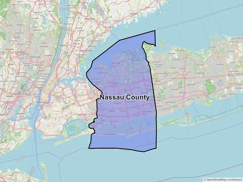
Map of Nassau county, New York with ZIP codes
Cities and Communities in Nassau County
Compare the largest cities in Nassau County by population, median income, and growth. Use the table below to analyze key demographic shifts across the region.
| City | Population | Median incomeHousehold | ZIP codes |
|---|---|---|---|
| Hempstead | 59,169 | $90,420 | 3ZIPs |
| Levittown | 51,758 | $146,068 | 1ZIPs |
| Freeport | 44,472 | $120,625 | 1ZIPs |
| Hicksville | 43,869 | $144,471 | 3ZIPs |
| Valley Stream | 40,634 | $133,190 | 3ZIPs |
| East Meadow | 37,796 | $133,971 | 1ZIPs |
| Elmont | 35,265 | $114,217 | 1ZIPs |
| Long Beach | 35,029 | $140,739 | 1ZIPs |
| Baldwin | 33,919 | $145,472 | 1ZIPs |
| Oceanside | 32,637 | $149,560 | 1ZIPs |
| Uniondale | 32,473 | $124,684 | 3ZIPs |
| Franklin Square | 30,903 | $143,263 | 1ZIPs |
| Glen Cove | 28,365 | $92,064 | 1ZIPs |
| Plainview | 27,100 | $189,906 | 1ZIPs |
| Rockville Centre | 26,016 | $151,938 | 2ZIPs |
| Garden City | 23,272 | $244,152 | 3ZIPs |
| Merrick | 22,040 | $185,740 | 1ZIPs |
| Massapequa | 21,355 | $181,846 | 1ZIPs |
| Mineola | 20,800 | $137,739 | 1ZIPs |
| Lynbrook | 20,438 | $136,696 | 1ZIPs |
| West Hempstead | 19,835 | $164,127 | 1ZIPs |
| Syosset | 19,259 | $187,273 | 1ZIPs |
| Woodmere | 18,669 | $172,537 | 1ZIPs |
| Wantagh | 18,613 | $179,362 | 1ZIPs |
| Roosevelt | 18,066 | $135,069 | 1ZIPs |
| Massapequa Park | 17,109 | $171,953 | 1ZIPs |
| Port Washington | 16,753 | $170,127 | 6ZIPs |
| Bethpage | 16,658 | $122,257 | 1ZIPs |
| Bellmore | 16,297 | $161,674 | 1ZIPs |
| Floral Park | 16,172 | $150,084 | 3ZIPs |
| Westbury | 15,864 | $145,185 | 1ZIPs |
| Seaford | 15,251 | $172,557 | 1ZIPs |
| Jericho | 14,808 | $167,935 | 2ZIPs |
| Inwood | 11,340 | $94,342 | 1ZIPs |
| Great Neck | 11,145 | $137,981 | 7ZIPs |
| New Hyde Park | 10,257 | $142,927 | 2ZIPs |
| East Rockaway | 10,159 | $124,929 | 1ZIPs |
| Woodbury | 9,335 | $191,321 | 1ZIPs |
| Malverne | 8,560 | $149,489 | 1ZIPs |
| Farmingdale | 8,466 | $122,980 | 2ZIPs |
| Manhasset | 8,176 | $165,932 | 1ZIPs |
| Williston Park | 7,591 | $156,382 | 1ZIPs |
| Cedarhurst | 7,374 | $101,572 | 1ZIPs |
| Hewlett | 7,262 | $140,765 | 1ZIPs |
| Oyster Bay | 7,049 | $111,264 | 1ZIPs |
| Lawrence | 6,809 | $170,000 | 1ZIPs |
| Bayville | 6,748 | $149,191 | 1ZIPs |
| Roslyn Heights | 6,747 | $175,263 | 1ZIPs |
| Old Bethpage | 6,403 | $195,202 | 1ZIPs |
| Albertson | 5,220 | $132,955 | 1ZIPs |
| Sea Cliff | 5,062 | $193,590 | 1ZIPs |
| Carle Place | 5,005 | $145,500 | 1ZIPs |
| Island Park | 4,928 | $104,926 | 1ZIPs |
| Glen Head | 4,837 | $138,465 | 1ZIPs |
| Old Westbury | 4,289 | $250,001 | 1ZIPs |
| Glenwood Landing | 3,948 | $131,573 | 1ZIPs |
| Locust Valley | 3,571 | $152,472 | 1ZIPs |
| Roslyn | 2,988 | $116,386 | 1ZIPs |
| East Norwich | 2,792 | $204,071 | 1ZIPs |
| Atlantic Beach | 1,707 | $165,565 | 1ZIPs |
| Point Lookout | 1,527 | $81,635 | 1ZIPs |
| Bellerose | 1,173 | $232,250 | 1ZIPs |
| Greenvale | 1,069 | $120,125 | 1ZIPs |
| Mill Neck | 1,054 | $196,359 | 1ZIPs |
— Data unavailable or suppressed by the U.S. Census Bureau for areas with small sample sizes to protect individual privacy.
ZIP Codes in Nassau County
Review the most populated postal areas across Nassau County. Use the ranking below to compare resident density and demographic scales between the county's major zones.
| ZIP | City | Median incomeHousehold | Population (ZIP) |
|---|---|---|---|
| 11550 | Hempstead | $92,677 | 61,901 |
| 11758 | Massapequa | $154,110 | 54,226 |
| 11590 | Westbury | $152,960 | 47,838 |
| 11520 | Freeport | $121,748 | 45,121 |
| 11003 | Elmont | $124,115 | 43,979 |
| 11040 | New Hyde Park | $154,696 | 43,075 |
| 11580 | Valley Stream | $137,402 | 43,026 |
| 11756 | Levittown | $146,019 | 42,501 |
| 11801 | Hicksville | $145,788 | 41,779 |
| 11561 | Long Beach | $141,629 | 39,132 |
| 11554 | East Meadow | $133,971 | 37,796 |
| 11710 | Bellmore | $173,054 | 35,155 |
| 11566 | Merrick | $177,079 | 35,147 |
| 11510 | Baldwin | $147,319 | 34,617 |
| 11735 | Farmingdale | $139,443 | 32,989 |
| 11793 | Wantagh | $167,068 | 32,121 |
| 11050 | Port Washington | $154,225 | 31,512 |
| 11572 | Oceanside | $148,790 | 31,157 |
| 11803 | Plainview | $187,514 | 30,049 |
| 11542 | Glen Cove | $93,242 | 29,171 |
Data Sources & Citations
The geographic and demographic information presented on this site is compiled from publicly available, authoritative sources, including:
- United States Census BureauDemographic, population, housing, and socioeconomic data sourced from Census Bureau datasets, including the Decennial Census and the American Community Survey (ACS).Census Data
- United States Postal Service (USPS)ZIP code classifications, delivery types, and postal designations used for reference purposes. USPS ZIP codes are intended for mail delivery and may not always align exactly with Census geographic boundaries.USPS