State ProfileWV
West Virginia
Population: 1,793,716ZIP codes: 823Cities: 717Counties: 55
Demographics
Source: U.S. Census Bureau (ACS/Decennial). See data sources
People
Total population
1,793,716
People
Median age
42.9
Housing
Total households
740,840
Income
Median household income
$60,798
Housing
Total housing units
866,433
Employment
Employment rate
52.2%
Education
Bachelor’s degree or higher
24.4%
Healthcare
Insured population
94.2%
West Virginia details
| Capital | Charleston |
|---|---|
| State Code | WV |
| Timezone | Eastern Time (ET) |
| Coordinates | 38.6, -80.45 |
| Land area | 24,230 sq mi(62,755.5 km²) |
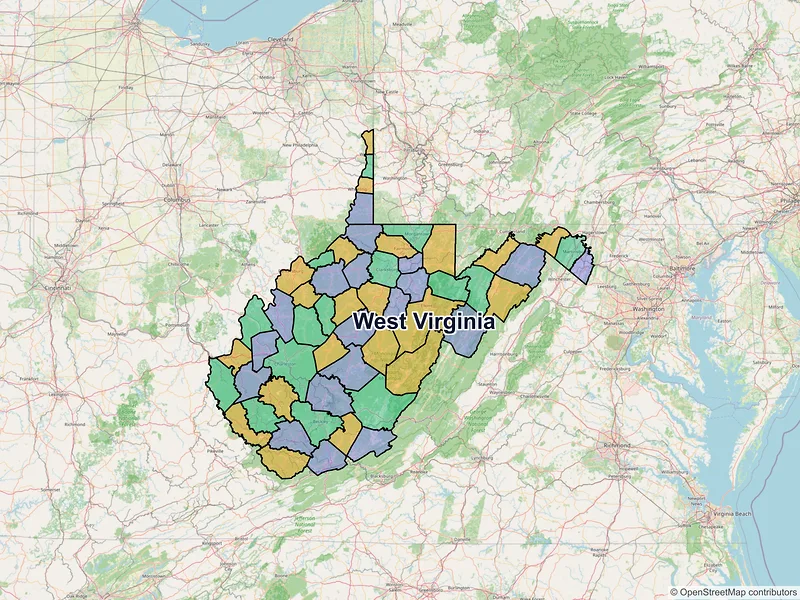
Map of West Virginia ZIP codes
Loading…
Major cities in West Virginia
Browse major cities in WV with population and key demographic indicators.
| City | County | Population | Median incomeHousehold | ZIP codes |
|---|---|---|---|---|
| Kanawha | 48,864 | $65,812 | 45ZIPs | |
| Cabell | 46,842 | $45,100 | 40ZIPs | |
| Monongalia | 30,347 | $44,727 | 7ZIPs | |
| Wood | 29,738 | $49,025 | 5ZIPs | |
| Ohio | 27,052 | $48,590 | 1ZIPs | |
| Hancock | 19,163 | $59,575 | 1ZIPs | |
| Berkeley | 18,777 | $59,555 | 5ZIPs | |
| Marion | 18,416 | $63,032 | 2ZIPs | |
| Raleigh | 17,286 | $45,826 | 2ZIPs | |
| Harrison | 16,061 | $47,386 | 3ZIPs | |
| Kanawha | 13,647 | $63,884 | 2ZIPs | |
| Morgan | 12,367 | — | 1ZIPs | |
| Kanawha | 10,861 | $53,972 | 1ZIPs | |
| Wood | 10,652 | $60,388 | 1ZIPs | |
| Mercer | 9,658 | $49,375 | 1ZIPs | |
| Harrison | 9,336 | $100,022 | 1ZIPs | |
| Berkeley | 9,299 | — | 1ZIPs | |
| Putnam | 9,215 | — | 1ZIPs | |
| Jefferson | 8,343 | — | 1ZIPs | |
| Fayette | 8,179 | $52,466 | 1ZIPs | |
| Marshall | 8,093 | $49,048 | 1ZIPs | |
| Kanawha | 7,480 | $58,379 | 1ZIPs | |
| Jefferson | 7,090 | — | 1ZIPs | |
| Putnam | 6,961 | $71,167 | 1ZIPs | |
| Randolph | 6,934 | $44,217 | 1ZIPs | |
| Kanawha | 6,624 | $53,848 | 1ZIPs | |
| Jefferson | 6,534 | $89,263 | 1ZIPs | |
| Mercer | 5,872 | $43,900 | 2ZIPs | |
| Wood | 5,811 | — | 3ZIPs | |
| Hampshire | 5,532 | — | 1ZIPs | |
| Wetzel | 5,204 | $60,946 | 1ZIPs | |
| Upshur | 5,186 | $54,615 | 1ZIPs | |
| Lincoln | 5,019 | — | 1ZIPs | |
| Mineral | 4,864 | $46,955 | 1ZIPs | |
| Taylor | 4,722 | $40,402 | 1ZIPs | |
| Cabell | 4,682 | — | 1ZIPs | |
| Cabell | 4,456 | $60,571 | 1ZIPs | |
| Berkeley | 4,402 | — | 1ZIPs | |
| Mason | 4,070 | $37,563 | 1ZIPs | |
| Lewis | 3,952 | $52,070 | 1ZIPs | |
| Greenbrier | 3,922 | $49,560 | 1ZIPs | |
| Jackson | 3,865 | $34,241 | 1ZIPs | |
| McDowell | 3,590 | $32,969 | 1ZIPs | |
| Webster | 3,439 | — | 1ZIPs | |
| Nicholas | 3,431 | $56,571 | 1ZIPs | |
| Berkeley | 3,426 | $84,286 | 1ZIPs | |
| Monongalia | 3,337 | — | 1ZIPs | |
| Raleigh | 3,169 | $67,407 | 1ZIPs | |
| Mingo | 3,083 | $21,875 | 1ZIPs | |
| Jackson | 3,079 | $41,518 | 1ZIPs | |
| Wayne | 3,033 | $53,683 | 1ZIPs | |
| Cabell | 3,016 | $73,318 | 1ZIPs | |
| Wood | 2,997 | $89,013 | 1ZIPs | |
| Preston | 2,980 | $71,154 | 1ZIPs | |
| Barbour | 2,929 | $45,879 | 1ZIPs | |
| Kanawha | 2,914 | $76,741 | 1ZIPs | |
| Boone | 2,913 | $58,872 | 1ZIPs | |
| Fayette | 2,887 | $67,623 | 1ZIPs | |
| Jackson | 2,849 | — | 1ZIPs | |
| Brooke | 2,848 | $58,371 | 1ZIPs | |
| Cabell | 2,811 | $46,429 | 1ZIPs | |
| Harrison | 2,745 | — | 1ZIPs | |
| Mercer | 2,734 | — | 1ZIPs | |
| Upshur | 2,680 | — | 1ZIPs | |
| Wetzel | 2,541 | $66,101 | 1ZIPs | |
| Hardy | 2,524 | $49,063 | 1ZIPs | |
| Wood | 2,455 | — | 1ZIPs | |
| Brooke | 2,450 | $42,868 | 1ZIPs | |
| Raleigh | 2,416 | $43,792 | 1ZIPs | |
| Putnam | 2,393 | $103,276 | 1ZIPs | |
| Harrison | 2,328 | $69,844 | 1ZIPs | |
| Grant | 2,284 | $42,917 | 1ZIPs | |
| Putnam | 2,280 | — | 1ZIPs | |
| Grant | 2,253 | — | 1ZIPs | |
| Summers | 2,245 | $37,610 | 1ZIPs | |
| Greenbrier | 2,221 | $46,178 | 1ZIPs | |
| Hancock | 2,208 | $56,607 | 1ZIPs | |
| Wood | 2,199 | — | 1ZIPs | |
| Nicholas | 2,173 | $39,943 | 1ZIPs | |
| Jackson | 2,087 | — | 1ZIPs | |
| Roane | 2,063 | $37,639 | 1ZIPs | |
| Raleigh | 2,045 | — | 1ZIPs | |
| Putnam | 1,988 | — | 1ZIPs | |
| Marion | 1,952 | $54,286 | 1ZIPs | |
| Mason | 1,943 | — | 1ZIPs | |
| Raleigh | 1,928 | $43,641 | 1ZIPs | |
| Pleasants | 1,831 | $63,547 | 1ZIPs | |
| Wayne | 1,810 | — | 1ZIPs | |
| Barbour | 1,805 | $48,508 | 1ZIPs | |
| Hardy | 1,791 | — | 1ZIPs | |
| Monroe | 1,763 | — | 1ZIPs | |
| Nicholas | 1,753 | — | 1ZIPs | |
| Hampshire | 1,724 | $49,286 | 1ZIPs | |
| Greenbrier | 1,720 | $24,411 | 1ZIPs | |
| Marshall | 1,697 | $40,446 | 1ZIPs | |
| Raleigh | 1,689 | $20,491 | 1ZIPs | |
| Jackson | 1,668 | — | 1ZIPs | |
| Nicholas | 1,660 | $30,833 | 1ZIPs | |
| Raleigh | 1,654 | $60,278 | 1ZIPs | |
| Ritchie | 1,631 | $47,768 | 1ZIPs | |
| Monroe | 1,625 | — | 1ZIPs | |
| Lincoln | 1,595 | $74,231 | 1ZIPs | |
| Greenbrier | 1,572 | $41,889 | 1ZIPs | |
| Logan | 1,552 | $101,546 | 1ZIPs | |
| Putnam | 1,542 | $78,578 | 1ZIPs | |
| Jefferson | 1,531 | $63,750 | 1ZIPs | |
| Harrison | 1,529 | $38,529 | 1ZIPs | |
| Marshall | 1,516 | — | 1ZIPs | |
| Greenbrier | 1,508 | — | 1ZIPs | |
| Boone | 1,503 | — | 1ZIPs | |
| Marshall | 1,496 | $82,308 | 1ZIPs | |
| Wyoming | 1,480 | $61,563 | 1ZIPs | |
| Greenbrier | 1,477 | — | 1ZIPs | |
| Mason | 1,476 | $55,938 | 1ZIPs | |
| Logan | 1,472 | — | 1ZIPs | |
| Fayette | 1,464 | — | 1ZIPs | |
| Preston | 1,464 | — | 1ZIPs | |
| Ohio | 1,454 | $43,750 | 1ZIPs | |
| Mingo | 1,450 | — | 1ZIPs | |
| Wyoming | 1,449 | $32,875 | 1ZIPs | |
| Cabell | 1,443 | — | 1ZIPs | |
| Wyoming | 1,443 | — | 1ZIPs | |
| Wayne | 1,443 | $27,159 | 1ZIPs | |
| Berkeley | 1,440 | $88,466 | 1ZIPs | |
| Logan | 1,439 | $29,832 | 1ZIPs | |
| Mineral | 1,436 | — | 1ZIPs | |
| Braxton | 1,417 | — | 1ZIPs | |
| Preston | 1,415 | $50,536 | 1ZIPs | |
| Tyler | 1,412 | $45,500 | 1ZIPs | |
| Wayne | 1,408 | $49,635 | 1ZIPs | |
| Roane | 1,407 | — | 1ZIPs | |
| Fayette | 1,403 | — | 1ZIPs | |
| Wood | 1,395 | — | 1ZIPs | |
| Mason | 1,376 | — | 1ZIPs | |
| Jefferson | 1,373 | — | 1ZIPs | |
| Monongalia | 1,355 | $31,901 | 1ZIPs | |
| Raleigh | 1,345 | $85,094 | 1ZIPs | |
| Raleigh | 1,341 | $57,813 | 1ZIPs | |
| Tucker | 1,327 | $40,547 | 1ZIPs | |
| Lincoln | 1,320 | — | 1ZIPs | |
| Hardy | 1,304 | — | 1ZIPs | |
| Fayette | 1,303 | $38,375 | 1ZIPs | |
| Cabell | 1,290 | — | 1ZIPs | |
| Mingo | 1,290 | — | 1ZIPs | |
| Mineral | 1,289 | $44,538 | 1ZIPs | |
| Fayette | 1,275 | $27,679 | 1ZIPs | |
| Monongalia | 1,268 | $90,478 | 1ZIPs | |
| Marshall | 1,252 | $43,636 | 1ZIPs | |
| Taylor | 1,243 | — | 1ZIPs | |
| Raleigh | 1,219 | — | 1ZIPs | |
| Putnam | 1,219 | — | 1ZIPs | |
| Raleigh | 1,215 | $44,219 | 1ZIPs | |
| Lincoln | 1,213 | — | 1ZIPs | |
| Putnam | 1,211 | $64,583 | 1ZIPs | |
| Boone | 1,211 | — | 1ZIPs | |
| Nicholas | 1,203 | — | 1ZIPs | |
| Hancock | 1,203 | $60,278 | 1ZIPs | |
| Marion | 1,201 | $78,558 | 1ZIPs | |
| Greenbrier | 1,201 | — | 1ZIPs | |
| Raleigh | 1,192 | — | 1ZIPs | |
| Greenbrier | 1,190 | $35,625 | 1ZIPs | |
| Summers | 1,177 | — | 1ZIPs | |
| Lewis | 1,174 | — | 1ZIPs | |
| Kanawha | 1,169 | $77,031 | 1ZIPs | |
| Barbour | 1,155 | — | 1ZIPs | |
| Wood | 1,151 | $60,365 | 1ZIPs | |
| Preston | 1,143 | $81,285 | 1ZIPs | |
| Clay | 1,136 | — | 1ZIPs | |
| Raleigh | 1,130 | $36,080 | 1ZIPs | |
| Raleigh | 1,129 | $30,870 | 1ZIPs | |
| Gilmer | 1,129 | $47,422 | 1ZIPs | |
| Mingo | 1,126 | — | 1ZIPs | |
| Fayette | 1,125 | $34,375 | 2ZIPs | |
| Kanawha | 1,116 | $69,858 | 1ZIPs | |
| Fayette | 1,093 | — | 1ZIPs | |
| Lincoln | 1,092 | — | 1ZIPs | |
| Jackson | 1,089 | — | 1ZIPs | |
| Wyoming | 1,086 | — | 1ZIPs | |
| Kanawha | 1,081 | $83,000 | 1ZIPs | |
| Mercer | 1,072 | — | 1ZIPs | |
| Wayne | 1,066 | — | 1ZIPs | |
| Wyoming | 1,058 | — | 1ZIPs | |
| Ritchie | 1,054 | $51,327 | 1ZIPs | |
| Braxton | 1,048 | — | 1ZIPs | |
| Greenbrier | 1,042 | — | 1ZIPs | |
| Lincoln | 1,039 | $61,429 | 1ZIPs | |
| Boone | 1,029 | — | 1ZIPs | |
| Logan | 1,020 | $41,369 | 1ZIPs | |
| Hancock | 1,020 | $32,292 | 1ZIPs | |
| Lincoln | 1,019 | — | 1ZIPs | |
| Monroe | 1,008 | — | 1ZIPs | |
| Mingo | 1,000 | — | 1ZIPs | |
| Monroe | 1,000 | — | 1ZIPs | |
| Pocahontas | 998 | $37,273 | 1ZIPs | |
| Hardy | 986 | — | 1ZIPs | |
| Calhoun | 983 | — | 1ZIPs | |
| Logan | 983 | — | 1ZIPs | |
| Greenbrier | 975 | $32,212 | 1ZIPs | |
| Raleigh | 974 | — | 1ZIPs | |
| Mingo | 969 | — | 1ZIPs | |
| Kanawha | 964 | — | 1ZIPs | |
| Mercer | 962 | $56,667 | 1ZIPs | |
| Calhoun | 939 | — | 1ZIPs | |
| Raleigh | 939 | — | 1ZIPs | |
| Wayne | 932 | $54,554 | 1ZIPs | |
| Hampshire | 931 | — | 1ZIPs | |
| Roane | 924 | — | 1ZIPs | |
| Wayne | 922 | — | 1ZIPs | |
| Jackson | 916 | — | 1ZIPs | |
| Boone | 915 | — | 1ZIPs | |
| Mineral | 906 | $90,775 | 1ZIPs | |
| Raleigh | 902 | $66,422 | 1ZIPs | |
| Wirt | 900 | — | 1ZIPs | |
| Logan | 899 | — | 1ZIPs | |
| Lincoln | 894 | — | 1ZIPs | |
| Clay | 878 | — | 1ZIPs | |
| Greenbrier | 877 | $28,194 | 1ZIPs | |
| Pleasants | 875 | $49,851 | 1ZIPs | |
| Putnam | 874 | $77,292 | 1ZIPs | |
| Mason | 866 | $45,893 | 1ZIPs | |
| Braxton | 863 | $42,817 | 1ZIPs | |
| Marshall | 861 | $43,750 | 1ZIPs | |
| Kanawha | 854 | $69,583 | 1ZIPs | |
| Marshall | 847 | — | 1ZIPs | |
| Marion | 828 | $48,000 | 1ZIPs | |
| Hardy | 823 | — | 1ZIPs | |
| Kanawha | 822 | $72,875 | 1ZIPs | |
| Hampshire | 814 | — | 1ZIPs | |
| Calhoun | 811 | — | 1ZIPs | |
| Mason | 807 | — | 1ZIPs | |
| Harrison | 805 | $63,636 | 1ZIPs | |
| McDowell | 799 | — | 1ZIPs | |
| Lincoln | 798 | — | 1ZIPs | |
| Barbour | 796 | — | 1ZIPs | |
| Logan | 783 | $102,589 | 1ZIPs | |
| Brooke | 781 | $60,313 | 1ZIPs | |
| Boone | 779 | — | 1ZIPs | |
| Boone | 778 | — | 1ZIPs | |
| Pendleton | 776 | — | 1ZIPs | |
| McDowell | 773 | $41,603 | 1ZIPs | |
| Logan | 772 | $60,000 | 1ZIPs | |
| Wood | 772 | — | 1ZIPs | |
| Jackson | 771 | — | 1ZIPs | |
| Roane | 770 | — | 1ZIPs | |
| Clay | 763 | — | 1ZIPs | |
| Braxton | 759 | $33,500 | 1ZIPs | |
| Fayette | 754 | $45,417 | 1ZIPs | |
| Grant | 749 | — | 1ZIPs | |
| Summers | 744 | — | 1ZIPs | |
| Logan | 740 | — | 1ZIPs | |
| Mason | 735 | $43,750 | 1ZIPs | |
| Wirt | 724 | $22,353 | 1ZIPs | |
| Tyler | 719 | — | 1ZIPs | |
| Kanawha | 718 | $44,952 | 1ZIPs | |
| Mineral | 718 | $42,375 | 1ZIPs | |
| Harrison | 717 | $47,917 | 1ZIPs | |
| Tyler | 717 | $69,375 | 1ZIPs | |
| Clay | 711 | — | 1ZIPs | |
| Kanawha | 703 | $53,750 | 1ZIPs | |
| Doddridge | 703 | — | 1ZIPs | |
| Clay | 703 | — | 1ZIPs | |
| Lewis | 702 | — | 1ZIPs | |
| Monongalia | 702 | — | 1ZIPs | |
| Randolph | 701 | — | 1ZIPs | |
| Mason | 690 | — | 1ZIPs | |
| McDowell | 685 | — | 1ZIPs | |
| Marion | 685 | $64,688 | 1ZIPs | |
| Kanawha | 681 | — | 1ZIPs | |
| Jackson | 680 | — | 1ZIPs | |
| Wayne | 675 | — | 1ZIPs | |
| Boone | 672 | $23,571 | 1ZIPs | |
| Ohio | 669 | $48,281 | 1ZIPs | |
| Lincoln | 668 | — | 1ZIPs | |
| Nicholas | 658 | — | 1ZIPs | |
| Roane | 658 | — | 1ZIPs | |
| Gilmer | 658 | — | 1ZIPs | |
| Preston | 656 | — | 1ZIPs | |
| Grant | 654 | — | 1ZIPs | |
| Doddridge | 653 | $60,417 | 1ZIPs | |
| Wyoming | 645 | $56,528 | 1ZIPs | |
| Mingo | 641 | — | 1ZIPs | |
| Lewis | 638 | — | 1ZIPs | |
| Hampshire | 637 | — | 1ZIPs | |
| Jefferson | 635 | $94,821 | 1ZIPs | |
| Greenbrier | 633 | — | 1ZIPs | |
| McDowell | 623 | $29,500 | 1ZIPs | |
| Randolph | 622 | $30,000 | 1ZIPs | |
| Wetzel | 621 | — | 1ZIPs | |
| Wyoming | 620 | — | 1ZIPs | |
| Tucker | 611 | $56,042 | 1ZIPs | |
| Wyoming | 610 | — | 1ZIPs | |
| Summers | 609 | — | 1ZIPs | |
| Tucker | 600 | $47,446 | 1ZIPs | |
| Randolph | 600 | — | 1ZIPs | |
| Logan | 599 | $36,737 | 1ZIPs | |
| Fayette | 599 | $38,209 | 1ZIPs | |
| Boone | 599 | — | 1ZIPs | |
| Calhoun | 593 | — | 1ZIPs | |
| Logan | 593 | — | 1ZIPs | |
| Mineral | 591 | $41,477 | 1ZIPs | |
| McDowell | 588 | — | 1ZIPs | |
| Raleigh | 582 | $109,692 | 1ZIPs | |
| Raleigh | 582 | — | 1ZIPs | |
| Pendleton | 581 | — | 1ZIPs | |
| Mercer | 575 | $63,024 | 1ZIPs | |
| Upshur | 574 | — | 1ZIPs | |
| Lincoln | 573 | $40,938 | 1ZIPs | |
| Hampshire | 571 | — | 1ZIPs | |
| Kanawha | 569 | $42,315 | 1ZIPs | |
| Wyoming | 569 | — | 1ZIPs | |
| Lewis | 569 | — | 1ZIPs | |
| Wyoming | 567 | — | 1ZIPs | |
| Hampshire | 565 | — | 1ZIPs | |
| Randolph | 560 | $47,852 | 1ZIPs | |
| Braxton | 558 | — | 1ZIPs | |
| Randolph | 556 | — | 1ZIPs | |
| Putnam | 556 | $28,876 | 1ZIPs | |
| Brooke | 553 | $33,125 | 1ZIPs | |
| Fayette | 553 | $25,625 | 1ZIPs | |
| Kanawha | 552 | — | 1ZIPs | |
| Logan | 545 | — | 1ZIPs | |
| Marion | 542 | $98,953 | 1ZIPs | |
| Raleigh | 538 | — | 1ZIPs | |
| Clay | 538 | — | 1ZIPs | |
| Lewis | 538 | — | 1ZIPs | |
| Greenbrier | 538 | — | 1ZIPs | |
| Mercer | 536 | — | 1ZIPs | |
| Boone | 530 | — | 1ZIPs | |
| Preston | 530 | $66,125 | 1ZIPs | |
| Summers | 529 | — | 1ZIPs | |
| Fayette | 528 | $30,884 | 1ZIPs | |
| Mingo | 527 | — | 1ZIPs | |
| Wyoming | 525 | — | 1ZIPs | |
| Mingo | 525 | — | 1ZIPs | |
| Lincoln | 524 | $17,500 | 1ZIPs | |
| Logan | 523 | — | 1ZIPs | |
| Marion | 523 | — | 1ZIPs | |
| Hampshire | 519 | — | 1ZIPs | |
| Raleigh | 518 | — | 1ZIPs | |
| Harrison | 513 | $27,500 | 1ZIPs | |
| Summers | 512 | — | 1ZIPs | |
| Preston | 510 | $54,643 | 1ZIPs | |
| Mason | 503 | $51,635 | 1ZIPs | |
| Wyoming | 501 | — | 1ZIPs | |
| Hampshire | 498 | — | 1ZIPs | |
| Pendleton | 495 | $63,889 | 1ZIPs | |
| Calhoun | 494 | $28,438 | 1ZIPs | |
| Kanawha | 494 | — | 1ZIPs | |
| Fayette | 493 | — | 1ZIPs | |
| Roane | 491 | — | 1ZIPs | |
| Logan | 491 | $56,178 | 1ZIPs | |
| Pocahontas | 489 | — | 1ZIPs | |
| Mingo | 489 | — | 1ZIPs | |
| Webster | 487 | $27,708 | 1ZIPs | |
| Logan | 483 | — | 1ZIPs | |
| Nicholas | 483 | — | 1ZIPs | |
| Kanawha | 483 | $63,558 | 1ZIPs | |
| Pendleton | 480 | — | 1ZIPs | |
| Clay | 480 | — | 1ZIPs | |
| Webster | 477 | — | 1ZIPs | |
| Kanawha | 477 | — | 1ZIPs | |
| Kanawha | 475 | — | 1ZIPs | |
| Wyoming | 470 | — | 1ZIPs | |
| Randolph | 470 | — | 1ZIPs | |
| McDowell | 470 | — | 1ZIPs | |
| Fayette | 468 | — | 1ZIPs | |
| Lewis | 467 | — | 1ZIPs | |
| Calhoun | 467 | — | 1ZIPs | |
| Pocahontas | 465 | — | 1ZIPs | |
| Greenbrier | 465 | — | 1ZIPs | |
| Gilmer | 464 | — | 1ZIPs | |
| Wayne | 461 | — | 1ZIPs | |
| Fayette | 461 | — | 1ZIPs | |
| Wyoming | 457 | — | 1ZIPs | |
| Boone | 455 | — | 1ZIPs | |
| Hampshire | 455 | $62,014 | 1ZIPs | |
| Greenbrier | 451 | — | 1ZIPs | |
| Mercer | 450 | — | 1ZIPs | |
| Harrison | 449 | $73,846 | 1ZIPs | |
| McDowell | 448 | — | 1ZIPs | |
| Monroe | 448 | $38,750 | 1ZIPs | |
| Hampshire | 448 | — | 1ZIPs | |
| Wyoming | 446 | — | 1ZIPs | |
| Fayette | 441 | — | 1ZIPs | |
| Preston | 438 | $61,964 | 1ZIPs | |
| Marshall | 437 | — | 1ZIPs | |
| Kanawha | 436 | — | 1ZIPs | |
| McDowell | 434 | — | 1ZIPs | |
| Calhoun | 426 | — | 1ZIPs | |
| Mingo | 422 | $40,750 | 1ZIPs | |
| Marion | 422 | — | 1ZIPs | |
| Hampshire | 420 | $64,306 | 1ZIPs | |
| Logan | 420 | — | 1ZIPs | |
| Monroe | 419 | $35,000 | 1ZIPs | |
| Logan | 416 | $64,390 | 1ZIPs | |
| Greenbrier | 412 | — | 1ZIPs | |
| Mingo | 412 | $16,105 | 1ZIPs | |
| Harrison | 412 | — | 1ZIPs | |
| Morgan | 410 | $65,000 | 1ZIPs | |
| Mercer | 409 | — | 1ZIPs | |
| Nicholas | 409 | — | 1ZIPs | |
| Lewis | 408 | $56,063 | 1ZIPs | |
| Fayette | 408 | — | 1ZIPs | |
| Raleigh | 408 | — | 1ZIPs | |
| Braxton | 407 | — | 1ZIPs | |
| Pendleton | 407 | — | 1ZIPs | |
| Randolph | 405 | — | 1ZIPs | |
| Wyoming | 405 | — | 1ZIPs | |
| Jackson | 404 | — | 1ZIPs | |
| Hampshire | 403 | — | 1ZIPs | |
| Ritchie | 402 | — | 1ZIPs | |
| Randolph | 398 | — | 1ZIPs | |
| Clay | 396 | — | 1ZIPs | |
| Gilmer | 396 | — | 1ZIPs | |
| Boone | 395 | — | 1ZIPs | |
| Clay | 394 | — | 1ZIPs | |
| Braxton | 394 | $55,938 | 1ZIPs | |
| Calhoun | 392 | — | 1ZIPs | |
| Marion | 392 | $72,045 | 1ZIPs | |
| Marion | 390 | — | 1ZIPs | |
| Putnam | 387 | $94,375 | 1ZIPs | |
| Harrison | 387 | — | 1ZIPs | |
| Barbour | 384 | $21,250 | 1ZIPs | |
| Summers | 384 | — | 1ZIPs | |
| McDowell | 382 | — | 1ZIPs | |
| Fayette | 380 | — | 1ZIPs | |
| Mingo | 376 | — | 1ZIPs | |
| Ritchie | 374 | — | 1ZIPs | |
| Marion | 373 | $55,583 | 1ZIPs | |
| Cabell | 373 | $55,354 | 1ZIPs | |
| Hardy | 372 | — | 1ZIPs | |
| Wood | 369 | $68,507 | 1ZIPs | |
| Braxton | 368 | — | 1ZIPs | |
| McDowell | 364 | — | 1ZIPs | |
| Wetzel | 363 | $43,333 | 1ZIPs | |
| Gilmer | 363 | — | 1ZIPs | |
| Raleigh | 362 | — | 1ZIPs | |
| Fayette | 362 | — | 1ZIPs | |
| Boone | 361 | $47,917 | 1ZIPs | |
| Brooke | 361 | $42,270 | 1ZIPs | |
| Harrison | 359 | $78,571 | 1ZIPs | |
| Logan | 353 | — | 1ZIPs | |
| Greenbrier | 352 | — | 1ZIPs | |
| Logan | 350 | — | 1ZIPs | |
| Wyoming | 347 | $25,548 | 1ZIPs | |
| Boone | 345 | — | 1ZIPs | |
| Webster | 341 | — | 1ZIPs | |
| Fayette | 341 | $250,001 | 1ZIPs | |
| Harrison | 339 | $103,229 | 1ZIPs | |
| Raleigh | 338 | — | 1ZIPs | |
| Randolph | 336 | — | 1ZIPs | |
| Raleigh | 334 | — | 1ZIPs | |
| Mingo | 333 | $55,000 | 1ZIPs | |
| Lewis | 332 | — | 1ZIPs | |
| Nicholas | 330 | — | 1ZIPs | |
| Wyoming | 330 | — | 1ZIPs | |
| Wyoming | 329 | — | 1ZIPs | |
| Wyoming | 327 | — | 1ZIPs | |
| Fayette | 324 | $43,750 | 1ZIPs | |
| Mercer | 323 | — | 1ZIPs | |
| Hampshire | 322 | — | 1ZIPs | |
| Fayette | 322 | — | 1ZIPs | |
| Boone | 320 | $97,222 | 1ZIPs | |
| Upshur | 319 | $52,202 | 1ZIPs | |
| Raleigh | 319 | — | 1ZIPs | |
| Fayette | 318 | — | 1ZIPs | |
| Wyoming | 318 | — | 1ZIPs | |
| Wyoming | 317 | — | 1ZIPs | |
| Mingo | 317 | $35,750 | 1ZIPs | |
| McDowell | 316 | — | 1ZIPs | |
| Morgan | 315 | $53,173 | 1ZIPs | |
| Boone | 314 | — | 1ZIPs | |
| Mingo | 313 | $44,234 | 1ZIPs | |
| Logan | 310 | $43,491 | 1ZIPs | |
| Taylor | 309 | $62,188 | 1ZIPs | |
| Nicholas | 309 | — | 1ZIPs | |
| Hancock | 309 | — | 1ZIPs | |
| Boone | 308 | — | 1ZIPs | |
| Fayette | 307 | — | 1ZIPs | |
| Fayette | 304 | — | 1ZIPs | |
| Berkeley | 300 | $89,141 | 1ZIPs | |
| Monroe | 299 | — | 1ZIPs | |
| Preston | 296 | $65,565 | 1ZIPs | |
| Webster | 286 | — | 1ZIPs | |
| Lincoln | 285 | — | 1ZIPs | |
| Wyoming | 284 | — | 1ZIPs | |
| Boone | 281 | — | 1ZIPs | |
| Logan | 279 | — | 1ZIPs | |
| Wyoming | 278 | — | 1ZIPs | |
| Wetzel | 278 | $63,942 | 1ZIPs | |
| Mercer | 276 | $53,929 | 1ZIPs | |
| Ohio | 275 | $58,125 | 1ZIPs | |
| Kanawha | 273 | — | 1ZIPs | |
| Pendleton | 271 | — | 1ZIPs | |
| Jefferson | 269 | $116,587 | 1ZIPs | |
| Hardy | 269 | $33,750 | 1ZIPs | |
| Boone | 267 | — | 1ZIPs | |
| Mingo | 266 | — | 1ZIPs | |
| McDowell | 265 | — | 1ZIPs | |
| Braxton | 264 | $53,625 | 1ZIPs | |
| Boone | 260 | — | 1ZIPs | |
| Wyoming | 259 | $61,875 | 1ZIPs | |
| Preston | 259 | $51,821 | 1ZIPs | |
| McDowell | 257 | $36,591 | 1ZIPs | |
| Wetzel | 255 | $45,938 | 1ZIPs | |
| Calhoun | 254 | — | 1ZIPs | |
| Grant | 253 | — | 1ZIPs | |
| Logan | 250 | — | 1ZIPs | |
| Hampshire | 250 | — | 1ZIPs | |
| Preston | 249 | $60,000 | 1ZIPs | |
| Wyoming | 248 | — | 1ZIPs | |
| Boone | 246 | — | 1ZIPs | |
| Raleigh | 245 | — | 1ZIPs | |
| Boone | 245 | — | 1ZIPs | |
| Raleigh | 245 | $47,788 | 1ZIPs | |
| Fayette | 244 | — | 1ZIPs | |
| Harrison | 244 | $78,669 | 1ZIPs | |
| Raleigh | 243 | — | 1ZIPs | |
| Logan | 243 | $50,655 | 1ZIPs | |
| Roane | 241 | — | 1ZIPs | |
| Fayette | 239 | — | 1ZIPs | |
| Webster | 239 | — | 1ZIPs | |
| Kanawha | 238 | — | 1ZIPs | |
| Logan | 234 | — | 1ZIPs | |
| Pocahontas | 232 | $51,188 | 1ZIPs | |
| Clay | 231 | — | 1ZIPs | |
| Pocahontas | 231 | $59,750 | 1ZIPs | |
| McDowell | 231 | $50,208 | 1ZIPs | |
| Gilmer | 229 | — | 1ZIPs | |
| Mason | 228 | $34,479 | 1ZIPs | |
| Tucker | 228 | $58,333 | 1ZIPs | |
| Logan | 228 | — | 1ZIPs | |
| Nicholas | 227 | — | 1ZIPs | |
| Kanawha | 227 | $18,938 | 1ZIPs | |
| Kanawha | 225 | — | 1ZIPs | |
| Marion | 224 | — | 1ZIPs | |
| Raleigh | 224 | — | 1ZIPs | |
| Kanawha | 223 | $105,150 | 1ZIPs | |
| Harrison | 222 | — | 1ZIPs | |
| Greenbrier | 222 | $36,250 | 1ZIPs | |
| Gilmer | 222 | — | 1ZIPs | |
| Raleigh | 221 | — | 1ZIPs | |
| Ritchie | 221 | $52,917 | 1ZIPs | |
| Tucker | 218 | $48,750 | 1ZIPs | |
| Clay | 218 | — | 1ZIPs | |
| Braxton | 217 | — | 1ZIPs | |
| Wyoming | 215 | — | 1ZIPs | |
| Gilmer | 214 | — | 1ZIPs | |
| Fayette | 213 | — | 1ZIPs | |
| Mineral | 212 | $61,250 | 1ZIPs | |
| Mercer | 212 | — | 1ZIPs | |
| Raleigh | 211 | — | 1ZIPs | |
| McDowell | 209 | $32,500 | 1ZIPs | |
| McDowell | 207 | $22,116 | 1ZIPs | |
| Raleigh | 207 | — | 1ZIPs | |
| Logan | 207 | $99,115 | 1ZIPs | |
| Randolph | 207 | $83,125 | 1ZIPs | |
| Doddridge | 206 | — | 1ZIPs | |
| Wetzel | 206 | — | 1ZIPs | |
| Fayette | 203 | — | 1ZIPs | |
| Monroe | 203 | — | 1ZIPs | |
| Pocahontas | 203 | — | 1ZIPs | |
| Mercer | 202 | — | 1ZIPs | |
| Grant | 201 | $33,462 | 1ZIPs | |
| Harrison | 201 | $33,403 | 1ZIPs | |
| Preston | 200 | $55,444 | 1ZIPs | |
| Taylor | 199 | — | 1ZIPs | |
| McDowell | 198 | — | 1ZIPs | |
| Mingo | 198 | — | 1ZIPs | |
| Harrison | 197 | $54,524 | 1ZIPs | |
| Logan | 195 | — | 1ZIPs | |
| Wyoming | 194 | — | 1ZIPs | |
| Wyoming | 193 | — | 1ZIPs | |
| Fayette | 191 | $19,250 | 1ZIPs | |
| McDowell | 188 | — | 1ZIPs | |
| Mason | 187 | $78,262 | 1ZIPs | |
| Grant | 186 | — | 1ZIPs | |
| Pendleton | 185 | — | 1ZIPs | |
| Logan | 185 | — | 1ZIPs | |
| Upshur | 183 | — | 1ZIPs | |
| Fayette | 183 | — | 1ZIPs | |
| Gilmer | 180 | $35,938 | 1ZIPs | |
| Nicholas | 179 | — | 1ZIPs | |
| Marion | 179 | $33,750 | 1ZIPs | |
| Pendleton | 178 | — | 1ZIPs | |
| Boone | 177 | $75,000 | 1ZIPs | |
| Ritchie | 176 | $65,500 | 1ZIPs | |
| Fayette | 176 | — | 1ZIPs | |
| Fayette | 174 | — | 1ZIPs | |
| Wayne | 174 | — | 1ZIPs | |
| McDowell | 174 | — | 1ZIPs | |
| Pocahontas | 174 | — | 1ZIPs | |
| Mercer | 173 | $16,786 | 1ZIPs | |
| Preston | 172 | — | 1ZIPs | |
| Mercer | 172 | — | 1ZIPs | |
| Boone | 171 | — | 1ZIPs | |
| Boone | 170 | — | 1ZIPs | |
| Kanawha | 170 | — | 1ZIPs | |
| Raleigh | 167 | — | 1ZIPs | |
| Brooke | 166 | — | 1ZIPs | |
| McDowell | 165 | $38,000 | 1ZIPs | |
| Braxton | 165 | — | 1ZIPs | |
| Raleigh | 165 | — | 1ZIPs | |
| Doddridge | 165 | — | 1ZIPs | |
| Randolph | 163 | $36,125 | 1ZIPs | |
| Marion | 162 | $6,875 | 1ZIPs | |
| McDowell | 160 | — | 1ZIPs | |
| Boone | 159 | — | 1ZIPs | |
| Mercer | 158 | — | 1ZIPs | |
| Ritchie | 158 | — | 1ZIPs | |
| Fayette | 152 | $58,947 | 1ZIPs | |
| Hampshire | 150 | — | 1ZIPs | |
| Roane | 150 | $31,875 | 1ZIPs | |
| Raleigh | 148 | — | 1ZIPs | |
| Raleigh | 148 | — | 1ZIPs | |
| McDowell | 146 | — | 1ZIPs | |
| Randolph | 146 | — | 1ZIPs | |
| McDowell | 145 | — | 1ZIPs | |
| Randolph | 145 | $98,250 | 1ZIPs | |
| Monroe | 145 | — | 1ZIPs | |
| Pocahontas | 141 | $76,635 | 1ZIPs | |
| Raleigh | 141 | — | 1ZIPs | |
| Kanawha | 139 | — | 1ZIPs | |
| Logan | 139 | — | 1ZIPs | |
| Raleigh | 137 | — | 1ZIPs | |
| Mason | 137 | $33,750 | 1ZIPs | |
| Wayne | 136 | $44,083 | 1ZIPs | |
| Fayette | 136 | $28,750 | 1ZIPs | |
| Monongalia | 135 | — | 1ZIPs | |
| Ritchie | 135 | $53,618 | 1ZIPs | |
| Pocahontas | 134 | — | 1ZIPs | |
| Calhoun | 134 | — | 1ZIPs | |
| Webster | 132 | — | 1ZIPs | |
| Mineral | 131 | — | 1ZIPs | |
| Kanawha | 130 | — | 1ZIPs | |
| Wayne | 130 | — | 1ZIPs | |
| Wirt | 129 | — | 1ZIPs | |
| Barbour | 127 | $54,135 | 1ZIPs | |
| McDowell | 127 | — | 1ZIPs | |
| Webster | 126 | $55,917 | 1ZIPs | |
| Summers | 123 | — | 1ZIPs | |
| Fayette | 119 | — | 1ZIPs | |
| Monongalia | 118 | — | 1ZIPs | |
| Wyoming | 117 | — | 1ZIPs | |
| Greenbrier | 115 | — | 1ZIPs | |
| Fayette | 115 | — | 1ZIPs | |
| Jackson | 114 | — | 1ZIPs | |
| Wetzel | 114 | — | 1ZIPs | |
| Monongalia | 114 | — | 1ZIPs | |
| Kanawha | 111 | — | 1ZIPs | |
| Upshur | 110 | — | 1ZIPs | |
| McDowell | 109 | — | 1ZIPs | |
| Clay | 109 | — | 1ZIPs | |
| Boone | 107 | — | 1ZIPs | |
| Randolph | 106 | — | 1ZIPs | |
| McDowell | 104 | — | 1ZIPs | |
| Summers | 104 | — | 1ZIPs | |
| Wetzel | 103 | — | 1ZIPs | |
| Raleigh | 103 | — | 1ZIPs | |
| Wetzel | 103 | — | 1ZIPs | |
| Tyler | 101 | — | 1ZIPs | |
| Clay | 100 | — | 1ZIPs | |
| Jefferson | 100 | — | 1ZIPs | |
| Mingo | 96 | — | 1ZIPs | |
| Nicholas | 95 | — | 1ZIPs | |
| Randolph | 95 | — | 1ZIPs | |
| Randolph | 94 | — | 1ZIPs | |
| Fayette | 90 | — | 1ZIPs | |
| McDowell | 90 | — | 1ZIPs | |
| Marion | 88 | — | 1ZIPs | |
| Logan | 87 | — | 1ZIPs | |
| Taylor | 87 | — | 1ZIPs | |
| Nicholas | 86 | — | 1ZIPs | |
| Wyoming | 85 | — | 1ZIPs | |
| Harrison | 85 | — | 1ZIPs | |
| Logan | 83 | — | 1ZIPs | |
| McDowell | 82 | — | 1ZIPs | |
| Monongalia | 82 | — | 1ZIPs | |
| Raleigh | 82 | — | 1ZIPs | |
| Wyoming | 80 | — | 1ZIPs | |
| Ritchie | 79 | — | 1ZIPs | |
| Nicholas | 79 | $86,056 | 1ZIPs | |
| Jackson | 78 | — | 1ZIPs | |
| Nicholas | 78 | — | 1ZIPs | |
| Fayette | 77 | — | 1ZIPs | |
| McDowell | 74 | — | 1ZIPs | |
| Boone | 74 | — | 1ZIPs | |
| Nicholas | 69 | — | 1ZIPs | |
| Wyoming | 67 | — | 1ZIPs | |
| Pocahontas | 64 | $129,688 | 1ZIPs | |
| Webster | 64 | — | 1ZIPs | |
| Preston | 63 | $101,000 | 1ZIPs | |
| Fayette | 62 | — | 1ZIPs | |
| Summers | 62 | — | 1ZIPs | |
| McDowell | 62 | — | 1ZIPs | |
| Brooke | 59 | — | 1ZIPs | |
| Tucker | 57 | — | 1ZIPs | |
| Ritchie | 56 | — | 1ZIPs | |
| Raleigh | 51 | — | 1ZIPs | |
| Hardy | 48 | — | 1ZIPs | |
| Lincoln | 48 | — | 1ZIPs | |
| Upshur | 48 | — | 1ZIPs | |
| McDowell | 47 | — | 1ZIPs | |
| McDowell | 43 | — | 1ZIPs | |
| Randolph | 41 | — | 1ZIPs | |
| Randolph | 41 | — | 1ZIPs | |
| McDowell | 40 | — | 1ZIPs | |
| Wetzel | 39 | — | 1ZIPs | |
| Wyoming | 39 | — | 1ZIPs | |
| Pocahontas | 38 | — | 1ZIPs | |
| Randolph | 38 | — | 1ZIPs | |
| McDowell | 35 | — | 1ZIPs | |
| Berkeley | 31 | — | 1ZIPs | |
| Monroe | 15 | — | 1ZIPs | |
| Mercer | 11 | — | 1ZIPs | |
| Fayette | 5 | — | 1ZIPs | |
| Randolph | 0 | — | 1ZIPs |
Most Populated West Virginia ZIP Codes
A quick overview of the largest ZIP code areas in West Virginia. Browse the table below to see which local communities and cities have the highest concentration of residents.
Available counties in West Virginia
Explore regional data for West Virginia counties, including population metrics, median income, and total ZIP codes.
| County | Population | Households | Median incomeHousehold | ZIP codes |
|---|---|---|---|---|
| Kanawha | 180,745 | 76,459 | $60,943 | 76ZIPs |
| Berkeley | 122,076 | 51,021 | $80,815 | 11ZIPs |
| Monongalia | 105,822 | 44,629 | $65,346 | 15ZIPs |
| Cabell | 94,350 | 39,318 | $55,832 | 47ZIPs |
| Wood | 84,296 | 35,836 | $57,810 | 16ZIPs |
| Raleigh | 74,591 | 29,004 | $52,150 | 43ZIPs |
| Harrison | 65,921 | 26,353 | $60,377 | 20ZIPs |
| Mercer | 59,664 | 24,224 | $53,210 | 18ZIPs |
| Jefferson | 57,701 | 22,804 | $98,806 | 8ZIPs |
| Putnam | 57,440 | 23,251 | $79,527 | 11ZIPs |
| Marion | 56,205 | 23,339 | $67,370 | 16ZIPs |
| Ohio | 42,425 | 18,342 | $57,094 | 4ZIPs |
| Fayette | 40,488 | 15,948 | $53,194 | 42ZIPs |
| Wayne | 38,982 | 15,762 | $58,878 | 12ZIPs |
| Preston | 34,216 | 12,809 | $61,880 | 14ZIPs |
| Greenbrier | 32,977 | 14,788 | $48,218 | 19ZIPs |
| Logan | 32,567 | 12,760 | $49,723 | 31ZIPs |
| Marshall | 30,591 | 12,487 | $59,169 | 8ZIPs |
| Hancock | 29,095 | 12,824 | $61,466 | 5ZIPs |
| Randolph | 27,932 | 10,678 | $52,757 | 21ZIPs |
| Jackson | 27,791 | 11,515 | $58,845 | 12ZIPs |
| Mineral | 26,938 | 11,120 | $69,375 | 8ZIPs |
| Mason | 25,453 | 10,211 | $49,761 | 12ZIPs |
| Nicholas | 24,604 | 9,466 | $54,639 | 17ZIPs |
| Upshur | 23,816 | 9,557 | $54,338 | 7ZIPs |
| Mingo | 23,568 | 9,317 | $38,119 | 19ZIPs |
| Hampshire | 23,093 | 8,643 | $63,116 | 16ZIPs |
| Brooke | 22,559 | 9,675 | $54,316 | 7ZIPs |
| Boone | 21,809 | 7,927 | $57,093 | 28ZIPs |
| Wyoming | 21,382 | 8,068 | $48,440 | 34ZIPs |
| Lincoln | 20,463 | 7,673 | $46,205 | 14ZIPs |
| McDowell | 19,111 | 6,467 | $31,559 | 35ZIPs |
| Morgan | 17,063 | 7,342 | $72,179 | 3ZIPs |
| Lewis | 17,033 | 6,967 | $56,477 | 9ZIPs |
| Taylor | 16,705 | 6,604 | $57,795 | 5ZIPs |
| Barbour | 15,465 | 6,152 | $51,394 | 6ZIPs |
| Wetzel | 14,442 | 6,113 | $56,836 | 11ZIPs |
| Hardy | 14,299 | 5,954 | $49,272 | 8ZIPs |
| Roane | 14,028 | 5,704 | $45,778 | 8ZIPs |
| Braxton | 12,447 | 4,790 | $50,331 | 11ZIPs |
| Monroe | 12,376 | 4,619 | $56,750 | 10ZIPs |
| Summers | 11,959 | 4,680 | $40,699 | 10ZIPs |
| Grant | 10,976 | 4,393 | $62,361 | 7ZIPs |
| Ritchie | 8,444 | 3,389 | $50,582 | 10ZIPs |
| Webster | 8,378 | 2,899 | $43,839 | 9ZIPs |
| Tyler | 8,313 | 3,296 | $63,693 | 4ZIPs |
| Clay | 8,051 | 2,972 | $42,318 | 13ZIPs |
| Pocahontas | 7,869 | 3,181 | $42,119 | 11ZIPs |
| Doddridge | 7,808 | 2,554 | $57,401 | 4ZIPs |
| Pleasants | 7,653 | 2,769 | $60,932 | 2ZIPs |
| Gilmer | 7,408 | 2,254 | $47,981 | 9ZIPs |
| Tucker | 6,762 | 2,840 | $53,358 | 6ZIPs |
| Calhoun | 6,229 | 2,525 | $43,980 | 10ZIPs |
| Pendleton | 6,143 | 2,342 | $64,931 | 8ZIPs |
| Wirt | 5,194 | 2,041 | $49,867 | 3ZIPs |
Data Sources & Citations
The geographic and demographic information presented on this site is compiled from publicly available, authoritative sources, including:
- United States Census BureauDemographic, population, housing, and socioeconomic data sourced from Census Bureau datasets, including the Decennial Census and the American Community Survey (ACS).Census Data
- United States Postal Service (USPS)ZIP code classifications, delivery types, and postal designations used for reference purposes. USPS ZIP codes are intended for mail delivery and may not always align exactly with Census geographic boundaries.USPS