State ProfileMT
Montana
Population: 1,084,225ZIP codes: 400Cities: 356Counties: 56
Demographics
Source: U.S. Census Bureau (ACS/Decennial). See data sources
People
Total population
1,084,225
People
Median age
41.3
Housing
Total households
468,981
Income
Median household income
$75,340
Housing
Total housing units
539,622
Employment
Employment rate
61%
Education
Bachelor’s degree or higher
36.3%
Healthcare
Insured population
91.2%
Montana details
| Capital | Helena |
|---|---|
| State Code | MT |
| Timezone | Mountain Time (MT) |
| Coordinates | 46.88, -110.36 |
| Land area | 147,040 sq mi(380,832.1 km²) |
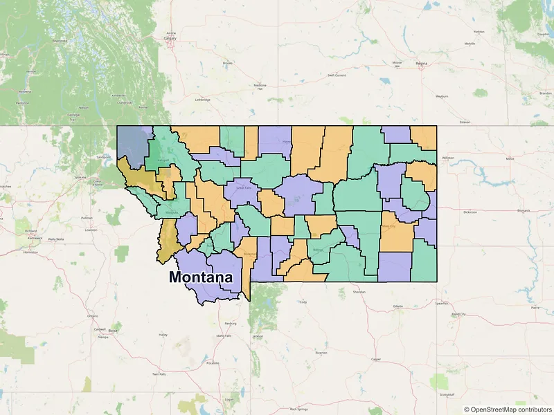
Map of Montana ZIP codes
Major cities in Montana
Browse major cities in MT with population and key demographic indicators.
| City | Population | Median incomeHousehold | ZIP codes | |
|---|---|---|---|---|
| Yellowstone | 117,116 | $73,712 | 14ZIPs | |
| Missoula | 73,489 | $70,392 | 8ZIPs | |
| Cascade | 60,442 | $63,373 | 5ZIPs | |
| Gallatin | 53,293 | $85,747 | 6ZIPs | |
| Silver Bow | 34,342 | — | 5ZIPs | |
| Lewis and Clark | 32,091 | $71,036 | 8ZIPs | |
| Flathead | 24,558 | $63,415 | 3ZIPs | |
| Gallatin | 10,460 | $97,328 | 1ZIPs | |
| Hill | 9,362 | $50,329 | 1ZIPs | |
| Deer Lodge | 9,234 | — | 1ZIPs | |
| Custer | 8,354 | $67,727 | 1ZIPs | |
| Park | 8,040 | $65,861 | 1ZIPs | |
| Flathead | 7,751 | $73,811 | 1ZIPs | |
| Yellowstone | 7,222 | $68,474 | 1ZIPs | |
| Richland | 6,346 | $62,538 | 1ZIPs | |
| Fergus | 5,952 | $48,750 | 1ZIPs | |
| Flathead | 5,308 | $75,766 | 1ZIPs | |
| Lake | 5,148 | $53,418 | 1ZIPs | |
| Flathead | 5,118 | $85,307 | 1ZIPs | |
| Dawson | 4,873 | $72,670 | 1ZIPs | |
| Ravalli | 4,659 | $49,204 | 1ZIPs | |
| Missoula | 4,399 | $86,065 | 1ZIPs | |
| Cascade | 4,131 | $64,833 | 1ZIPs | |
| Beaverhead | 3,880 | $61,134 | 1ZIPs | |
| Big Horn | 3,818 | $60,423 | 1ZIPs | |
| Gallatin | 3,591 | $138,805 | 1ZIPs | |
| Valley | 3,202 | $90,310 | 1ZIPs | |
| Toole | 3,169 | $58,413 | 1ZIPs | |
| Glacier | 3,056 | $49,432 | 1ZIPs | |
| Powell | 2,938 | $60,302 | 1ZIPs |
Most Populated Montana ZIP Codes
A quick overview of the largest ZIP code areas in Montana. Browse the table below to see which local communities and cities have the highest concentration of residents.
| ZIP | City | Median incomeHousehold | Population (ZIP) |
|---|---|---|---|
| 59901 | Kalispell | $72,523 | 57,900 |
| 59102 | Billings | $76,141 | 48,133 |
| 59718 | Bozeman | $99,123 | 43,831 |
| 59101 | Billings | $58,598 | 41,522 |
| 59715 | Bozeman | $88,407 | 37,286 |
| 59701 | Butte | $60,437 | 33,937 |
| 59405 | Great Falls | $59,449 | 33,578 |
| 59105 | Billings | $78,014 | 33,310 |
| 59601 | Helena | $72,290 | 30,848 |
| 59801 | Missoula | $58,347 | 30,629 |
| 59602 | Helena | $92,985 | 29,390 |
| 59404 | Great Falls | $83,867 | 28,131 |
| 59714 | Belgrade | $96,183 | 22,333 |
| 59808 | Missoula | $80,239 | 21,546 |
| 59106 | Billings | $125,833 | 20,681 |
| 59802 | Missoula | $67,736 | 19,892 |
| 59803 | Missoula | $111,925 | 17,203 |
| 59912 | Columbia Falls | $76,617 | 15,395 |
| 59840 | Hamilton | $61,752 | 14,466 |
| 59937 | Whitefish | $75,428 | 14,354 |
Available counties in Montana
Explore regional data for Montana counties, including population metrics, median income, and total ZIP codes.
| County | Population | Median incomeHousehold | ZIP codes |
|---|---|---|---|
| Yellowstone | 164,731 | $76,570 | 23ZIPs |
| Gallatin | 118,960 | $93,528 | 13ZIPs |
| Missoula | 117,922 | $75,598 | 16ZIPs |
| Flathead | 104,357 | $73,925 | 17ZIPs |
| Cascade | 84,414 | $67,690 | 18ZIPs |
| Lewis and Clark | 70,973 | $78,237 | 15ZIPs |
| Ravalli | 44,174 | $71,283 | 9ZIPs |
| Silver Bow | 35,133 | $61,754 | 8ZIPs |
| Lake | 31,134 | $63,360 | 12ZIPs |
| Lincoln | 19,677 | $47,143 | 7ZIPs |
| Park | 17,191 | $70,047 | 9ZIPs |
| Hill | 16,309 | $52,798 | 7ZIPs |
| Glacier | 13,778 | $46,875 | 4ZIPs |
| Big Horn | 13,124 | $58,750 | 10ZIPs |
| Sanders | 12,400 | $57,476 | 9ZIPs |
| Jefferson | 12,085 | $95,490 | 6ZIPs |
| Custer | 11,867 | $70,605 | 4ZIPs |
| Richland | 11,491 | $73,084 | 5ZIPs |
| Fergus | 11,446 | $63,706 | 9ZIPs |
| Roosevelt | 10,794 | $57,063 | 6ZIPs |
| Carbon | 10,473 | $80,261 | 10ZIPs |
| Deer Lodge | 9,421 | $57,527 | 2ZIPs |
| Beaverhead | 9,371 | $61,268 | 8ZIPs |
| Stillwater | 8,963 | $84,732 | 8ZIPs |
| Dawson | 8,940 | $71,334 | 4ZIPs |
| Madison | 8,623 | $75,250 | 11ZIPs |
| Rosebud | 8,329 | $49,914 | 10ZIPs |
| Valley | 7,578 | $71,695 | 10ZIPs |
| Blaine | 7,044 | $64,813 | 7ZIPs |
| Powell | 6,946 | $66,923 | 7ZIPs |
| Broadwater | 6,774 | $70,374 | 4ZIPs |
| Teton | 6,226 | $70,430 | 6ZIPs |
| Pondera | 5,898 | $52,338 | 5ZIPs |
| Chouteau | 5,895 | $58,218 | 7ZIPs |
| Toole | 4,971 | $57,731 | 8ZIPs |
| Musselshell | 4,730 | $58,920 | 4ZIPs |
| Mineral | 4,535 | $63,450 | 6ZIPs |
| Phillips | 4,217 | $53,417 | 6ZIPs |
| Sweet Grass | 3,678 | $77,000 | 4ZIPs |
| Sheridan | 3,539 | $70,147 | 10ZIPs |
| Granite | 3,309 | $59,265 | 3ZIPs |
| Fallon | 3,049 | $76,250 | 3ZIPs |
| Wheatland | 2,069 | $49,489 | 4ZIPs |
| Judith Basin | 2,023 | $59,000 | 6ZIPs |
| Liberty | 1,959 | $57,857 | 4ZIPs |
| Meagher | 1,927 | $71,932 | 3ZIPs |
| McCone | 1,729 | $69,375 | 3ZIPs |
| Powder River | 1,694 | $67,045 | 6ZIPs |
| Daniels | 1,661 | $55,625 | 5ZIPs |
| Carter | 1,415 | $54,167 | 4ZIPs |
| Garfield | 1,173 | $69,583 | 6ZIPs |
| Prairie | 1,088 | $51,250 | 2ZIPs |
| Wibaux | 937 | $67,462 | 1ZIPs |
| Golden Valley | 823 | $58,333 | 2ZIPs |
| Treasure | 762 | $67,917 | 3ZIPs |
| Petroleum | 496 | $60,208 | 1ZIPs |
Data Sources & Citations
The geographic and demographic information presented on this site is compiled from publicly available, authoritative sources, including:
- United States Census BureauDemographic, population, housing, and socioeconomic data sourced from Census Bureau datasets, including the Decennial Census and the American Community Survey (ACS).Census Data
- United States Postal Service (USPS)ZIP code classifications, delivery types, and postal designations used for reference purposes. USPS ZIP codes are intended for mail delivery and may not always align exactly with Census geographic boundaries.USPS