County ProfileMD
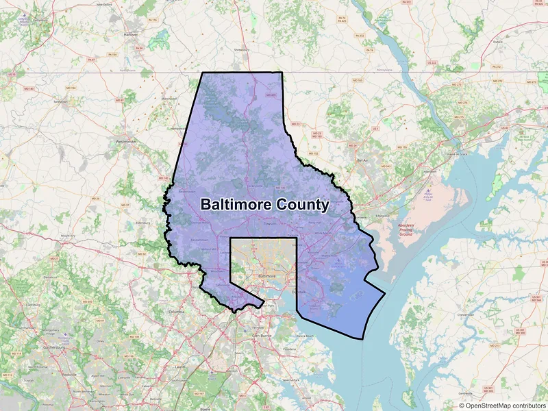
Baltimore County
Population: 854,535 · 86 ZIP codes
Demographics
Source: U.S. Census Bureau (ACS/Decennial). Estimates vary by year.
People
Total population
854,535
People
Median age
39.7
Housing
Total households
332,801
Income
Median household income
$91,768
Housing
Total housing units
350,821
Employment
Employment rate
62.4%
Education
Bachelor’s degree or higher
42.3%
Healthcare
Insured population
94.6%
County details
Local time 02:48:58(ET)| Name | Baltimore |
|---|---|
| Total ZIP codes | 86total |
| ZIP codes (by type) | 58 Standard13 PO Box15 Unique |
| Area code | 410, 443, 667 |
| Timezone | Eastern Time (ET) |
| Coordinates | 39.4431666, -76.6165693 |
| Land area | 598.4 sq miles(1,549.7 km²) |
Map of Baltimore county, Maryland with ZIP codes
Cities and Communities in Baltimore County
Compare the largest cities in Baltimore County by population, median income, and growth. Use the table below to analyze key demographic shifts across the region.
| City | Population | Median incomeHousehold | ZIP codes |
|---|---|---|---|
| Baltimore | 585,708 | $62,177 | 40ZIPs |
| Dundalk | 67,796 | $64,520 | 1ZIPs |
| Towson | 59,553 | $101,320 | 5ZIPs |
| Gwynn Oak | 46,595 | — | 1ZIPs |
| Catonsville | 44,701 | $114,109 | 1ZIPs |
| Nottingham | 40,555 | — | 1ZIPs |
| Essex | 40,505 | $67,168 | 1ZIPs |
| Lutherville Timonium | 38,677 | — | 2ZIPs |
| Windsor Mill | 38,015 | — | 1ZIPs |
| Halethorpe | 35,837 | — | 1ZIPs |
| Owings Mills | 35,674 | $96,243 | 1ZIPs |
| Pikesville | 34,168 | $98,465 | 2ZIPs |
| Randallstown | 33,655 | $85,735 | 1ZIPs |
| Middle River | 33,203 | $78,398 | 1ZIPs |
| Parkville | 31,812 | $79,178 | 1ZIPs |
| Perry Hall | 29,409 | $106,244 | 1ZIPs |
| Reisterstown | 26,822 | $85,543 | 1ZIPs |
| Cockeysville | 24,184 | $77,680 | 1ZIPs |
| Rosedale | 19,961 | $85,711 | 1ZIPs |
| White Marsh | 10,287 | $117,426 | 1ZIPs |
| Sparrows Point | 9,594 | — | 1ZIPs |
| Phoenix | 7,468 | — | 1ZIPs |
| Curtis Bay | 7,368 | — | 1ZIPs |
| Parkton | 7,178 | — | 1ZIPs |
| Sparks Glencoe | 6,045 | — | 1ZIPs |
| Monkton | 5,062 | — | 1ZIPs |
| Baldwin | 4,861 | — | 1ZIPs |
| Kingsville | 4,358 | $128,563 | 1ZIPs |
| Glen Arm | 4,060 | — | 1ZIPs |
| Freeland | 3,199 | — | 1ZIPs |
| Upperco | 2,553 | — | 1ZIPs |
| Stevenson | 865 | — | 1ZIPs |
| Hydes | 815 | — | 1ZIPs |
| Glyndon | 619 | — | 1ZIPs |
| Fort Howard | 430 | — | 1ZIPs |
| Upper Falls | 259 | — | 1ZIPs |
| Fork | 256 | — | 1ZIPs |
| Butler | 89 | — | 1ZIPs |
| Maryland Line | 56 | — | 1ZIPs |
| Hunt Valley | 11 | — | 2ZIPs |
— Data unavailable or suppressed by the U.S. Census Bureau for areas with small sample sizes to protect individual privacy.
ZIP Codes in Baltimore County
Review the most populated postal areas across Baltimore County. Use the ranking below to compare resident density and demographic scales between the county's major zones.
| ZIP | City | Median incomeHousehold | Population (ZIP) |
|---|---|---|---|
| 21234 | Parkville | $83,517 | 67,308 |
| 21117 | Owings Mills | $101,831 | 59,154 |
| 21222 | Dundalk | $64,141 | 59,062 |
| 21224 | Baltimore | $89,017 | 54,266 |
| 21215 | Baltimore | $51,587 | 54,198 |
| 21228 | Catonsville | $112,656 | 50,418 |
| 21206 | Baltimore | $64,531 | 49,470 |
| 21207 | Gwynn Oak | $67,060 | 46,595 |
| 21218 | Baltimore | $62,488 | 46,238 |
| 21220 | Middle River | $81,817 | 44,568 |
| 21229 | Baltimore | $60,047 | 43,464 |
| 21221 | Essex | $67,340 | 43,381 |
| 21236 | Nottingham | $95,149 | 40,555 |
| 21093 | Lutherville Timonium | $125,528 | 38,677 |
| 21244 | Windsor Mill | $85,114 | 38,015 |
| 21230 | Baltimore | $91,842 | 36,660 |
| 21227 | Halethorpe | $85,986 | 35,837 |
| 21208 | Pikesville | $90,131 | 35,007 |
| 21136 | Reisterstown | $118,500 | 34,973 |
| 21212 | Baltimore | $96,685 | 32,317 |
Data Sources & Citations
The geographic and demographic information presented on this site is compiled from publicly available, authoritative sources, including:
- United States Census BureauDemographic, population, housing, and socioeconomic data sourced from Census Bureau datasets, including the Decennial Census and the American Community Survey (ACS).Census Data
- United States Postal Service (USPS)ZIP code classifications, delivery types, and postal designations used for reference purposes. USPS ZIP codes are intended for mail delivery and may not always align exactly with Census geographic boundaries.USPS